March 30, 2013
Seeing Wrong

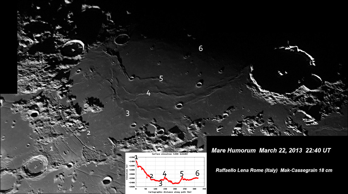
image by Raf Lena, Roma, Italia, and redline topo graph from LRO QuickMap; numbers are approximate matches of positions.
This classic image of the eastern half of the Humorum Basin isn't what it seems. I have always interpreted the scene this way.
The three or four curved rilles between Campanus and Hippalus always seemed to be a flat area, and then the surface tips
downward towards the center of the mare. The small insert is an elevation transet of the region from near the first rille (#1) and
the near the basin center (#6). But the area crossed by the rille (from 1 to 2) is a steady slope downward with a drop of 800 - 900
m; not flat at all. The area with a lighter gray mare (2 to 3) is nearly flat, but from where the dark mare begins (3) to the center of
the basin (6) doesn't drop down with a low center as most other basin floors do. I made several transects across the entire floor
of Mare Humorum and find the center to usually be the highest part of the mare, excepting some mare ridges. That is so unexpected
that it makes me question the accuracy of the Path tool in this location. It appears that from NW to SE the mare is domed up in
the middle, but from the NE to SW the mare dips consistently to the SW. So interpretation of images alone can lead us, or least
me, astray. And all the years, from Galileo to recent years, we missed the third dimension.
Chuck Wood
Related Links
Rükl plate 52
21st Century Atlas chart 23
Yesterday's LPOD: Melt Ribbon
Tomorrow's LPOD: Happy Spring
COMMENTS?
Register, Log in, and join in the comments.


