Image by K.C. Pau
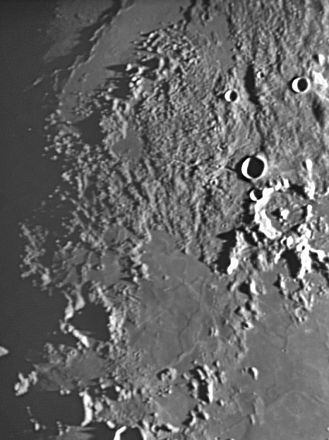
Pallas (white-rimmed with central peak) and Bode (small and shadow-filled), both right center, are the main named features here, but the interest is in the unnamed rubbly area in the top half of the image. This is presumably debris from the formation of the Imbrium impact basin whose center is roughly 800 km to the north-northeast. However, this area lacks Imbrium-radial features, but there are faint parallel lineations that trend to the northeast, essentially radial to the Serenitatis impact basin. Do you see these linear alignments to the left of Bode and Pallas? Are they Serenitatis scour marks that have been largely covered by Imbrium ejecta? One tightly sinuous rille is visible in a smooth-floored broad valley north of Bode. KC has previously acquired a high resolution view of this rille which was one of the sources for a large pyroclastic deposit that drapes the ruble but is invisible under this low Sun lighting. At the upper left is the diagonal edge of Sinus Aestuum. The shadows cast by grazing illumination across the concentric mare ridges make them appear as a rugged range rather than the low and gentle swells they really are. Don’t you love shadow magnification?
Technical Details:
Feb 6, 2006. 250 mm f/6 Newtonian + 2.5X barlow + Phillips Toucam Pro. 239 frames stacked.
Related Links:
Rükl plate 33
Yesterday's LPOD: Clumps & Tadpoles
Tomorrow's LPOD: A Ribbon of Darkness
COMMENTS?
Register, Log in, and join in the comments.


