September 8, 2004
Where in the Moon is Nielsen?
Image Credit: Apollo 15 AS15-88-11983 |
|
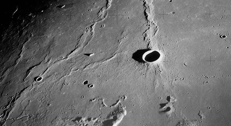
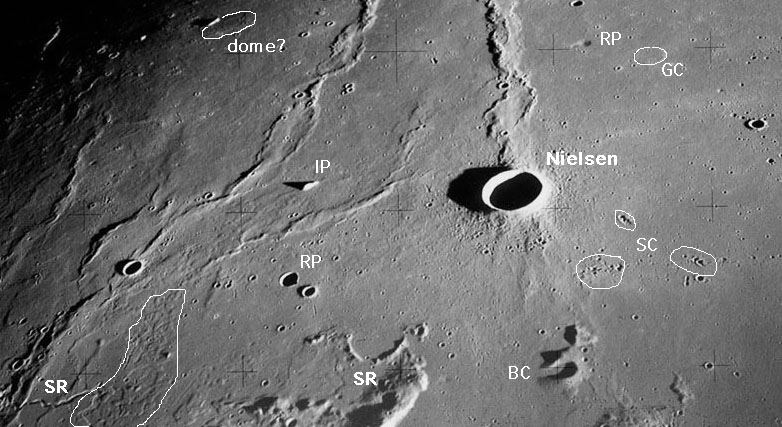
Where in the Moon is Nielsen? I must admit that I have never heard of the crater Nielsen, but then I realized that this was another unnecessary naming change left over from those nomenclaturally wild 1970s. Nielsen, named for both a Danish astronomer and an American physicist, slept through about 150 years with the unassuming designation of Wollaston C, given by Madler. But the relatively fresh Nielsen (diameter 10 km) is not the center of interest here in the marial doldrums between the Aristarchus Plateau and Rumker. With normal resolution this area does look uninteresting, but with the low sun and high res of this Apollo 15 Hasselblad camera view many volcanic features show up. First there are the braided-looking mare ridges, which may be part of an inner ring of the putative Procellarum (Gargantuan) basin or the equally poorly defined (on its western side) main rim of the Imbrium basin. The bottom left of the image includes the extreme northern ends of the Aristarchus Plateau and the Agricola Mountains. A few sinuous rilles (SR on mouseover) are visible, but a much larger area with uneven surface (outline in white) looks like terrestrial lava flow badlands full of multiple channels and collapses. South of Nielsen is a strange looking crater cone with a missing side. This looks very much like a breached cone (BC) such as often occurs in lava fields on Earth where a cone built by ash or lava eruptions has part of its wall carried away by a lava flow from the vent. If this were a lunar ash cone its diameter of about 4 km would make it the largest on the Moon. A few rimless pits (RP) are further signs of volcanic collapses, probably over buried lava tubes, and a special kind of ghost crater (GC) suggests an impact crater formed when lava was still plastic. Two final items of interest. What is the origin of the isolated peak (IP)? On the Moon, hills are usually remnants of a crater rim or part of a buried basin ring (e.g. Pico), but this looks like neither. Hmm. And finally, near the top left of the image is a broad oval swell - is this a dome? Technical Details: Related Links: Yesterday's LPOD: Helen's Husband Tomorrow's LPOD: Eight is Enough
|
Author & Editor: COMMENTS?Register, Log in, and join in the comments.
|


