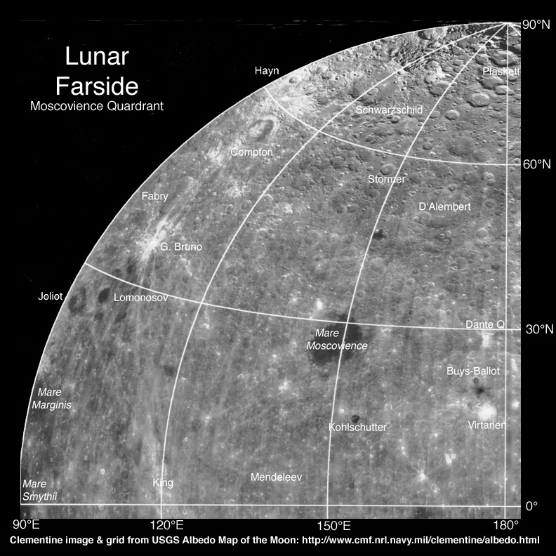
image from USGS Clementine mosaic, annotated by C.A. Wood
I get lost on the farside. I know the surfaces of Mars, Venus and Titan better than our own Moon’s averted hemisphere. Part of the reason is that there are very few maps of the farside - I would love to have the farside equivalent of the S&T Field Map of the Moon, which I use every day. But there is probably not a big enough market to justify any company creating one, so I am making my own. The image above is a orientation map of the NE quadrant of the farside. I started with the US Geological Survey Albedo Map of the Moon (which they worked hard to display accurately the differences in brightness) and distorted it to so that both light and dark areas showed maximum detail. And then I added the names of a few craters and maria to provide some orientation. The Clementine mosaic has too high of lighting to show decently most craters so it will probably not be a basis for a map with all craters identified. Of course, it has already been the basis of the Clementine Atlas of the Moon but that has a large enough scale - and accompanying shaded relief drawings - to make it possible to identify the craters. There are actually three other maps of the farside that include crater names. The revised National Geographic The Earth’s Moon, the USGS’ Color-Coded Topography and Shaded Relief Map of the Lunar Near Side and Far Side Hemispheres, and Rükl’s small hemispheric map on p 191 of his Atlas of the Moon. Perhaps when all the images from SMART-1 are mosaicked together an image map of the farside will be constructed and annotated with names - in the meantime I’ll make the other three farside quadrants.
Technical Details:
One-quarter of a full Clementine mosaic compiled by the USGS.
Related Links:
Another farside image mosaic made from Orbiter IV and V shots exists, but is not labelled with names, yet - perhaps it will be someday.
Yesterday's LPOD: Another Schiller
Tomorrow's LPOD: Banging Into the Moon
COMMENTS?
Register, Log in, and join in the comments.


