October 23, 2024
LGM
Originally published May 28, 2014
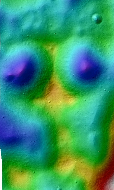
 image by NASA/ASU/LROC |
The Lunar Reconnaissance Orbiter Camera team has updated their fequently visited website. The new layout has an attractive, clean design with a lot of white space. It apparently has lost a few features I was regularly used, such as the calendar which indicated when new Featured Images were posted. Additionally, the previous layout of Featured Images included convenient thumbnails that allowed quick scrolling to find earlier images of interest. Now the images are gorgeously large which makes them more of an exhibit than a quick visual index. One of the most educational aspects of the earlier LROC website was that each Featured Image included an essay with context images that explained the scientific story of the target area. Now that is only available for a few of the images; hopefully the entire collection of explanations will be restored. In exploring the new layout I was attracted to the Reduced Data Records section of the Archives tab. RDRs are images that have been processed to make mosaics or mashed with altimetry to create colorful topographic images such as this one of LGM. These were available before but now seem more accessible. I admit confusion about the differences between the Regional Products and the Topographic Products. These two lists are the same for the first 185 items (all color-coded topo images), but the Regional Products list continues with 115 image mosaics; perhaps that list should just include the mosaics and be called Regional Mosaics. In both lists the products are arranged alphabetically by feature name; a map showing the locations of the special products would be a great visual index to add. These are my first impressions of a major website revision that I like. It is possible that I have not looked deeply enough to find some of the prior features I miss.
|
Yesterday's LPOD: Colorful Revelations
Tomorrow's LPOD: Welcome Back, Paolo!
COMMENTS?
Register, Log in, and join in the comments.


