November 7, 2019
A Call To Arms
Originally published June 26, 2010

image and analysis by Howard Eskildsen
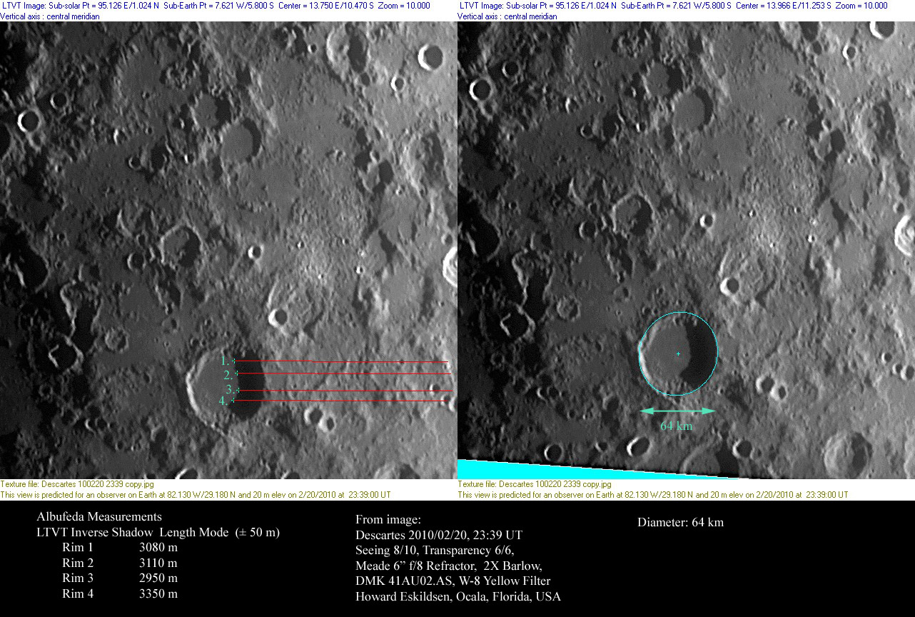
Earlier in the month Howard showed how easy it is to measure crater depths using LTVT. He can't stop doing it, partially because of the thrill of deriving accurate and useful information from his own images. When I looked at this latest effort I realized that although LRO altimetry data may very well be used to measure crater depths - because there are catalogs of craters that can be used to guide automated software routines to make the measurements - there are other types of lunar landforms that will be harder to measure robotically. I am thinking specifically of peaks. There must be hundreds - perhaps thousands? - of peaks that were lettered by Mädler, Neison and Schmidt for which no modern data are available. Most of these peaks were re-examined in the early 1960s for the maps accompanying the System of Lunar Craters, but they were not catalogued. It would be possible for a small group of people to follow Howard's example and the determine the locations and heights of all major lunar elevations. That would be a basic contribution to lunar knowledge. I would recommend using the highest resolution images available and systematically measure all the Greek-lettered peaks on the System maps or the summary Lunar Designations and Positions quadrant charts.
Chuck Wood
Technical Details
Howard's measurements are consistent with the older value of about 3.2 km, but not with the 1.2 km depth measured by Arthur and colleagues (probably me!) in the early 1970s. It will be useful for someone to use higher resolution images to determine the correct depth.
Related Links
Rükl plate 45
Yesterday's LPOD: A Sharper Image
Tomorrow's LPOD: Y or Why?
COMMENTS?
Register, Log in, and join in the comments.


