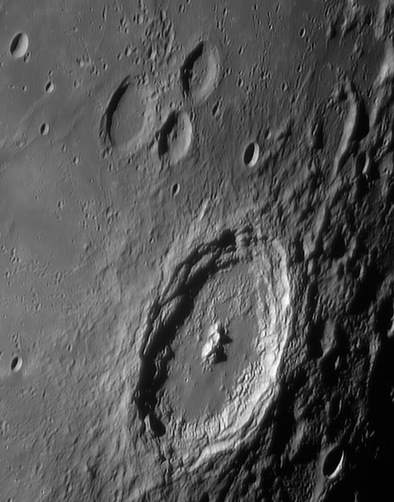
image by Павел Пресняков (Pavel Presnyakov), Kiev Ukraine
Yesterday’s map gives a height of 4,706 m for the southern peak and something over 4,300 m for the northern one. The flat floor south of the peaks is probably impact melt, and it has also been mapped 50 km beyond the rim to the southeast. The inner walls of Langrenus have always seemed untidy to me. Instead of the stair-step terraces as seen in many other large young craters, the ones here lack systematic structure, as if the sliding down of the walls was not controlled by fundamental fractures.
Technical Details:
27.10.2007, 23:10 UT. TAL-250K + EVS-135, b/w 1280×1024 15fps + barlow 3X, 250 frames from 4000 in Registax4.
Related Links:
Pavel’s website
PS - I just finished reading Red Star Rising, an exciting retelling of the competition between Korolev and Medaris to launch the first Earth satellite. I thought I knew this story but learned many new insider details - a great read!
Yesterday's LPOD: Lucky Lindy and Weird Ibn
Tomorrow's LPOD: Flying Over Tycho
COMMENTS?
Register, Log in, and join in the comments.


