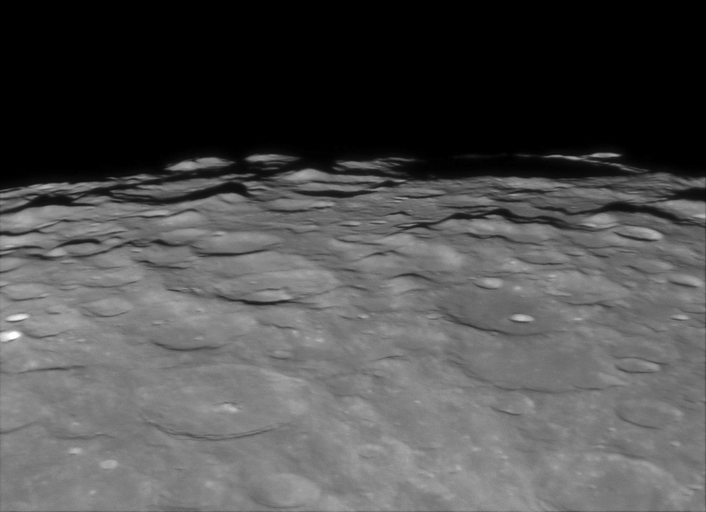
image by Tom Bash
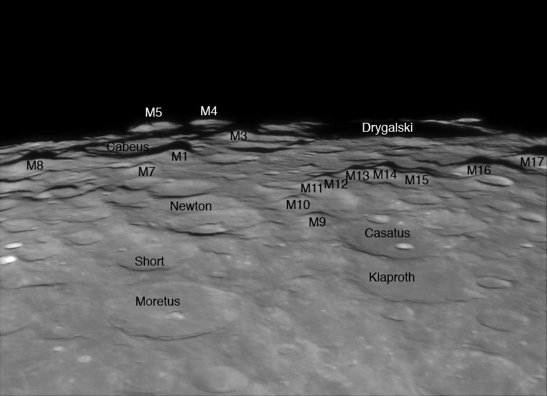
I am a sucker for the south pole. The scattered peaks, reputed to be the highest on the Moon, are always grand, and Tom’s image presents them under a dramatic illumination. The shadows make it easier than on some of the satellite images to identifiy which are the most massive peaks. On the slightly reduced version below I have added the numbers for isolated mountains. M1 through M6 are from Ewen Whitaker’s classic 1954 paper. Ewen’s M2, between M1 and M3, does not seem to be large enough to warrant a designation so its not on this map, maybe it looks better on other images. Because these peaks are becoming more important - they are near the pole and may be valuable as future South Pole-Aitken farside basin - I have added designations to 11 more, M7 to M17. These designations will make it easier for me to refer to these peaks in the future and may be useful to other observers as well. A challenging task would be to try to link these peaks to Greek letter designations given by Madler, Schmidt and Neison from the 19th century. Another, easier and more useful actitivity, would be to compile a list of the these peaks, including their latitudes, longitudes and heights.

Technical Details:
03 January 2007, 02:47 UT. 235 mm SCT @ f/20, Infinity 2-1M camera, best 70 of 800 frames stacked.
Related Links:
Rükl plates 73 & VI
Tom’s website
Ewen Whitaker (1954) The Lunar South Pole Regions, Journal British Astronomical Association, 64, pp 234-242. Ewen’s map also appears on p. 127 of The Modern Moon: A Personal View.
Yesterday's LPOD: Sacrebleu? No, Sacrobosco
Tomorrow's LPOD: Lacus Niger Major
COMMENTS?
Register, Log in, and join in the comments.


