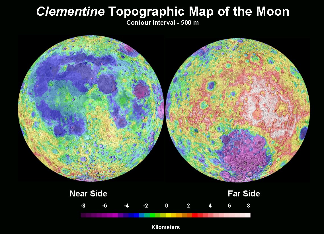
map courtesy of Paul Spudis, Baltimore, Maryland
This is the best topographic map of the Moon that exists. A laser altimeter on the Clementine spacecraft pinged the surface once per second resulting in an elevation measurement being obtained every 1-2 km with a horizontal footprint of 100 m and a vertical resolution of 40 m. Unfortunately, the distance between adjacent orbits was 40 km so the north-south resolution is much better than the east-west. This map was made at the Lunar and Planetary Institute by Paul Spudis and Brian Fessler. The topography is Clementine laser altimetry for most of the surface and Tony Cook’s photoclinometry for the polar regions; the basemap is the familiar US Geological Survey’s airbrush map. The farside is both higher and lower than the nearside. The farside highlands reach up to 8 km above the mean lunar radius and the deepest spot in the blue South Pole-Aitken basin is 8 km below the mean. Topography reveals various impact basins that are otherwise inconspicuous - notice the one south of Orientale.
Related Links:
Rükl charts: all
An older homepage for Paul
Yesterday's LPOD: Impossibly High Standard
Tomorrow's LPOD: Move Over Orbiter
COMMENTS?
Register, Log in, and join in the comments.


