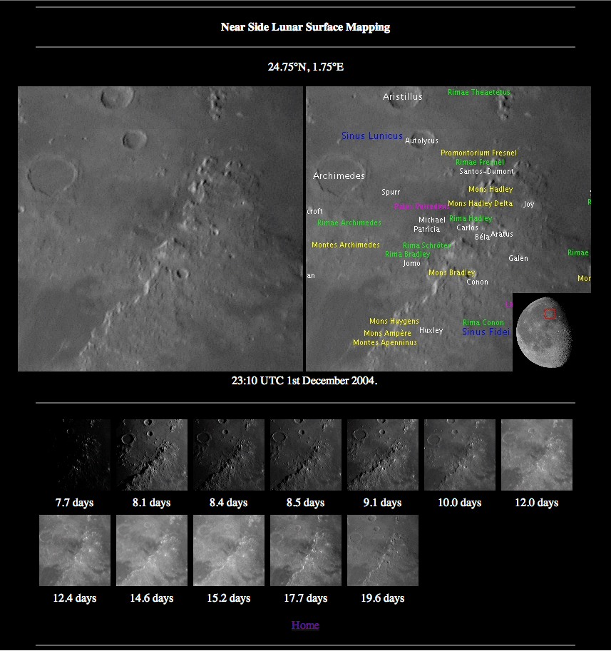
image by Julian James
A computer provides many ways to organize and display lunar images, but because each is taken at different times the field of view and librations are different and the image scale commonly varies due to changing Earth-Moon distances. Julian James has written software to experiment with displaying his own images in a consistent way. At his website there is a Mercator-projected image that can be clicked on to reveal a 400 x 400 pixel piece of a lunar image. An adjacent image provides designations, and below are thumbnails of all the other of Julian’s images of this same area. I really like this concept, especially clicking anywhere on the initial map and having clickable thumbnails to view an area under many different phases. This present incarnation of the software calculates librations for each image to accurately locate the names, but only works on images of the entire Moon. Julian is considering adding the capability of displaying closeup images, which would be quite useful. I would love to see an online image atlas based on an idea such as this, with high resolution images, accurate nomenclature, and many phase views of the same area. That would be a valuable and highly used resource! What other interesting lunar display software have LPOD users created? Has anyone used Google Moon to index their own images?
Technical Details:
All images made with a Celestron C8 and QuickCam Pro 4000.
Related Links:
Rükl plate 22
Yesterday's LPOD: A Rarely Seen Mess
Tomorrow's LPOD: Nomenclature Zoo
COMMENTS?
Register, Log in, and join in the comments.


