March 11, 2022
Little Slopes, New Observations
Originally published April 25, 2012

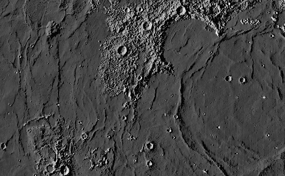
LRO LOLA data processed as an image by Maurice Collins, New Zealand
Maurice has constructed a marvelous series of maps that enhance low relief. He uses Jim Mosher's LTVT software to swing the Sun low in the sky, illuminating the digital topopraphy database from the LRO Lunar Orbiter Laser Altimeter. While looking at the Imbrium image I noticed a couple of things that may not have been seen before. First, from east (right) to west, I placed a small white + near the downslope end of the famous young Imbrium lava flows. They originate from vents about 425 km to the south, southwest of the +, near the isolated mountain La Hire. This may be the first image that shows the entire length of the flows. Next look at Sinus Iridum. The major arc of an Imbrium mare ridge basin ring curves through the southeast edge of the Sinus. But notice that another ridge outside the basin arc curves in the opposite direction, completing the arc of the Jura Mountain rim of the Iridum crater. This could be the mare ridge trace of the original rim that was down-dropped or tilted towards the center of the basin.The Imbrium mare ridge may mark a fault that lowered the rim. Inside Iridum there is a strong hint of a large circular feature anout 100 km wide and according to the Quick Map topo traverse about 125-140 m deep. Is this an impact crater covered by Imbrium lavas, or perhaps the inner ring of a small two-ring basin? Finally, look at the remarkably straight ridge that connects the Aristarchus Plateau to Rümker. According to the Quick Map this feature is about 325 km long, and the surface to the east is abruptly 150 to 300 m lower than west of the ridge. Interestingly this fault - for that is what it is - lines up with a short flat-floored rille at the northeast corner of the Plateau. Maurice's version of the LOLA data shows things that aren't apparent in the LRO images. I hope that LRO will release another global mosaic based on images with lower illumination. If that were a map choice for Quick Map it would make use of the altimetry tool less hit or miss.
Chuck Wood
Yesterday's LPOD: Tomorrow's Bridge, Yesterday's Moon
Tomorrow's LPOD: X-Raying Imbrium
COMMENTS?
Register, Log in, and join in the comments.


