June 26, 2014
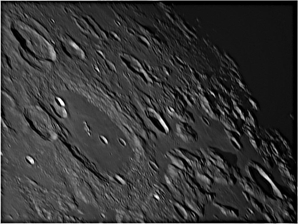
Half-Filled Trough

image by Jordi Delpeix Borrell, l'Ametlla del Vallès (Barcelona) Spain
The boundary between Cleomedes' ejecta on its southern side overlaps an inner ring of the Crisium Basin just at bottom center of Jordi's image. The basin ring is typically made up of large chunky blocks called massifs, but they are hidden by the crater ejecta. A diagonal brightening at the crater-basin boundary suggests a change in elevation. Measurements with the Path Tool on LRO's QuickMap shows that the bright ridge is a scarp that abruptly rises about 1.8 km going from north to south. If you look to the right of the boundary you will see that the massifs slope down to smooth maria; the same thing happens to the left off the bottom of the image. The drop from the mountains down to the maria is about 4 km. This fault-boundary is part of a large feature. A broader view with color shaded relief, reveals that most of the north and northeast side of the Crisium ring of massifs is bounded by a trough that is about 50 km wide, 1 km deep, and except for the Cleomedes ejecta, filled with lava. This is not common around inner rings of basins, although Imbrium and Serenitatis are so filled with lava that one simply does't know about them, It is nice that QuickMap shows that the ejecta is about 1.5 -2 km thick, just as would be expected from the difference between 4 km tall massifs and the 1.8 km high ejecta-covered scarp.
Chuck Wood
Technical Details
March/18/2014. C9,25" + Barlow 2X + ASI 120MM. Processed with Registax6
Related Links
21st Century Atlas chart 1.
Yesterday's LPOD: Perfect Morning for a New Day
Tomorrow's LPOD: Red and Blue
COMMENTS?
Register, Log in, and join in the comments.


