April 8, 2012
Inverted Topography?

image from wesbite of Maurice Collins, New Zealand
 |
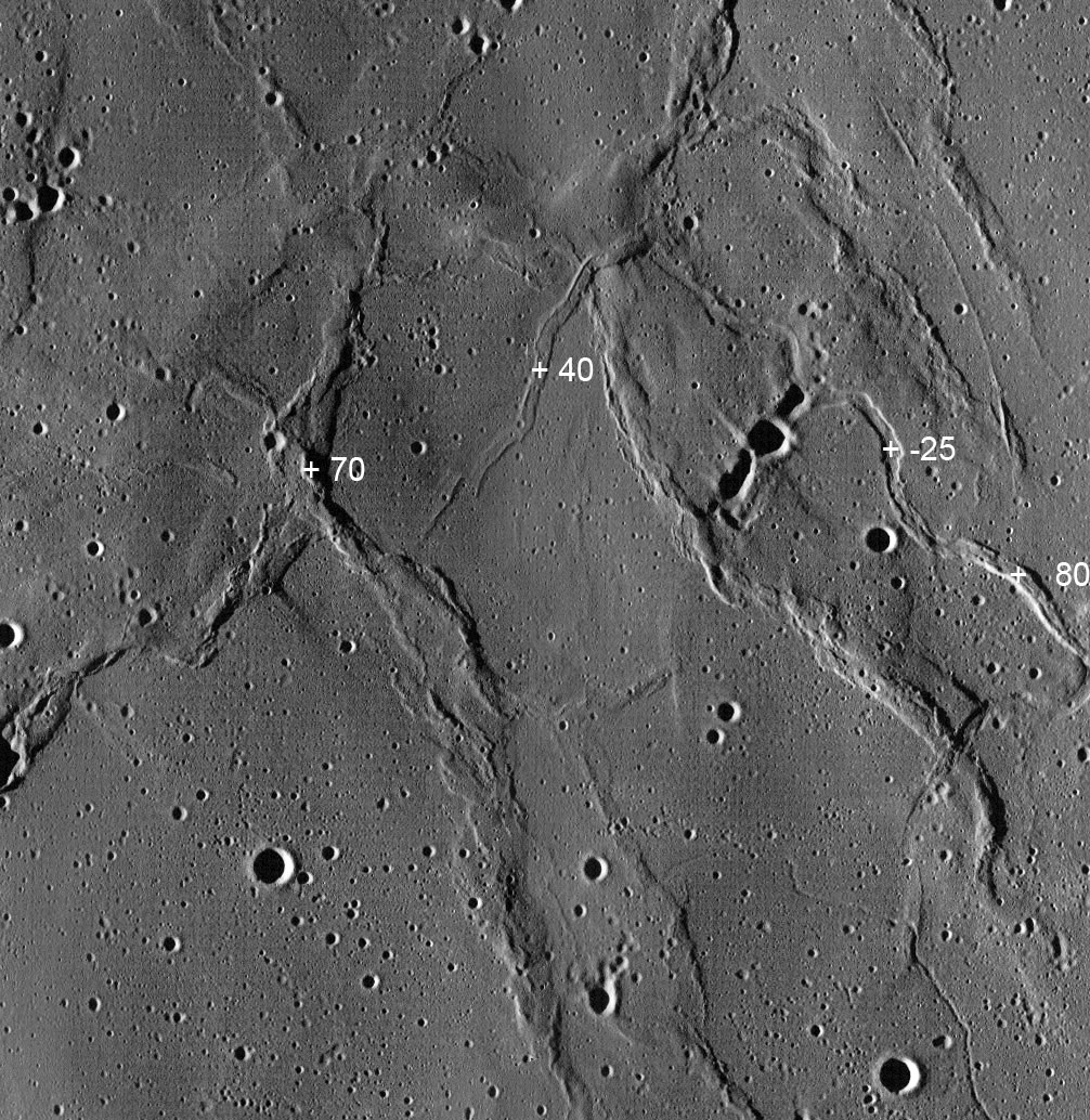
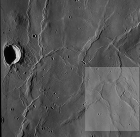
On Earth, sometimes differential erosion transforms a trough into a ridge. This is also common on Mars, where the floor of a valley is more resistent than surrounding sediments, which when eroded away leave a sinuous ridge. That explanation presumably won't work for the Moon. An enlargement of part of an LRO WAC image (left) constructed by Maurice shows inverted valley type landforms just east of the ring-ridged Lamont. I was first struck by the flat-topped ridge near the middle of the image marked 40. If you look closely at the surrounding craters you see that the illumination is from the west so that it is indeed a ridge rather than a flat-floored rille. Its southern end has an abrupt offset - en echelon as geologists say - just as happens to some rilles. Following the ridge northward it passes over a mare ridge and then turns sharply to the southeast where it becomes a flat-floored rille! The + marks a place where the rille floor is 25 m lower than the surrounding terrain, based on measurments with the LRO altimetry tool. Continuing to the southeast the feature inverts again and becomes an 80 m high ridge. Continuing to the south it transmogrifies once again into a rille and bends orthogonally until is cuts through the same ridge that it climbed over to the north. The rille peters out - as an incipient ridge? - in the mare near the beginning of the famous Diamondback Rille. I don't undertand how the ridge could shape shift back and forth into a rille. To check that there is not some perverse artifact in the WAC image I found the ridge near the 40 m mark appearing as a worm on one of Mike Wirth's earlier LPODs. A similar but less certain ridge snout is to the west of the 70 m height for the mare ridge. A final mystery is the very narrow slightly curved ridge crossing the north east quadrant of the image. Measurments with the LRO altimeter tool are very unsatisfactory because they do not confirm my interpretation that this is a ridge. The altimeter says it is a terrain that slopes upward from west to east and then flattens out. Balderdash. That can't be true but that is what it says. Must be time to go to bed.
Yesterday's LPOD: Learning To See From Lunar Orbit Tomorrow's LPOD: It is Left As an Exercise for the Student COMMENTS?Register, Log in, and join in the comments.
|


