April 29, 2013
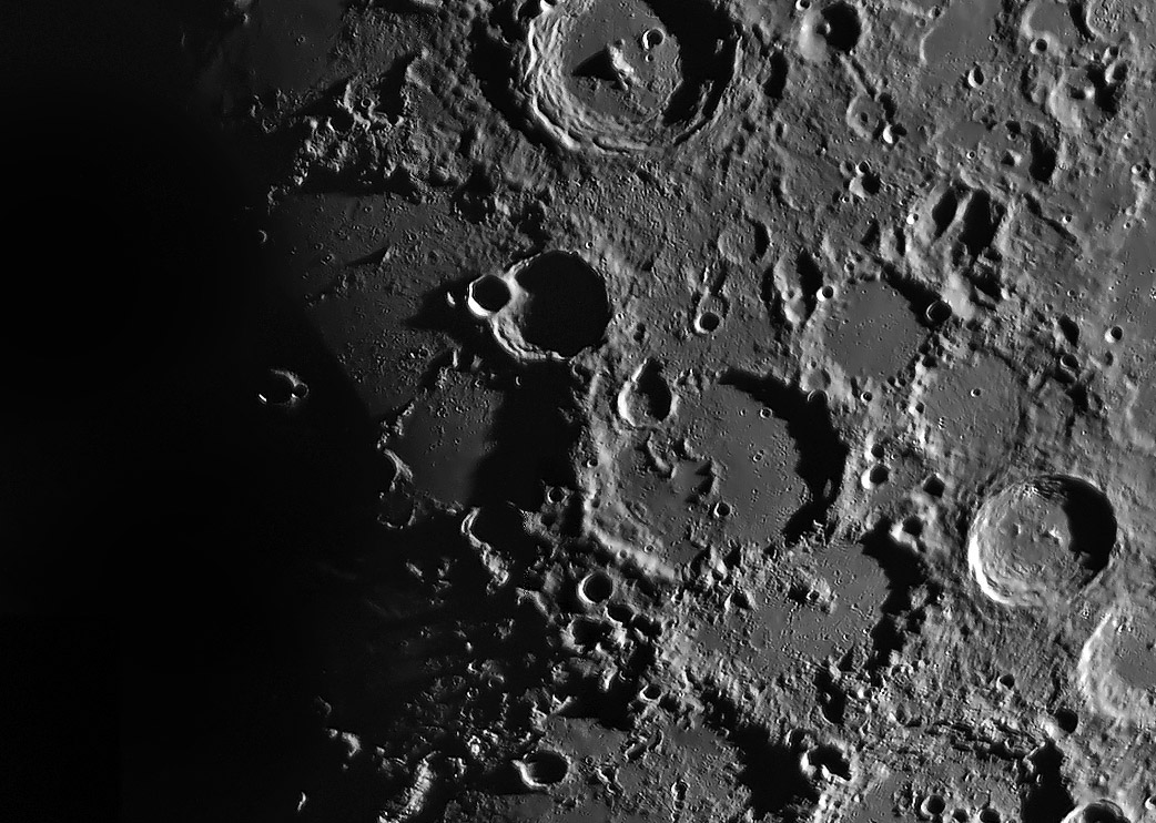
Half a Crater

image by Jose Cabello, Málaga, España
Ancient Thebit (AT) is an informal name for the approximately 200 km wide crater cut across its middle by the Straight Wall. As Jose's crisp image dramatically illustrates the fault precipitously drops the western surface over 300 m into pre-dawn shadows. What is amazing is that west of the fault the surface continues to slope downward so that the western rim of AT, indicated by a half ring of mare ridges, is 2 km lower than the eastern rim. Buried beneath Mare Nubium's lavas is the original floor of AT, with a possible answer to the question, What are the two straight ridges that cross the floor from about east to west? The only explanation I can think of is that they are the remnant of an inner ring, meaning that AT is a small basin. Was AT originally a central peak-ring basin like Antoniadi or Compton? Central peak-ring basins have both a central peak and an inner ring, and are a transition between large complex craters and larger two-ring basins. An oddity about this speculation is that AT's central peak would have to be about where the Straight Wall is, near the center of the crater. There is no evidence for a peak, so perhaps it is entirely on the down-dropped side of the fault and it must be very small, lower even than Antoniadi's.
Chuck Wood
Technical Details
04/18/2013. C11 f15 y DMK21au618
Related Links
Rükl plate 54
21st Century Atlas chart 16.
Yesterday's LPOD: Still Confused After All These Years
Tomorrow's LPOD: A Tribute
COMMENTS?
Register, Log in, and join in the comments.


