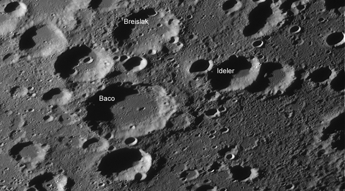
image by Wes Higgins
The crater named for Roger Bacon is deep in the southern highlands, far from young basins. The region is full of craters with a confusing sameness - you can’t recognize them for their distinctive features, a map is a necessary guide. Normally the spaces between the craters seem somewhat smooth with a hint of texture. But Wes’ low-Sun, high-res view captures a new level of detail that raises questions. The area between Baco and the eastern (right) edge of the frame looks like a stretch of beach that has handfuls of sand thrown onto it. There is a very high spatial density of small rounded hills; it’s not a landscape dominated by primary or secondary craters. This highly mottled texture does not occur on the floor of Ideler or the crater just to its right. But their rims show signs of pitting, much of which has been smoothed, probably by sliding of wall materials downslope. The textured terrain must be relatively old. Is it small blocks of debris thrown out of Nectaris by its formation? According to the US Geologic Survey geologic maps of 35 years ago, this area is just at the limit of Nectaris ejecta - but the Survey mappers didn’t have such excellent images to use. The reduced amount of hillocks within Ideler and some other craters illustrates once again that the floors of some of highland craters are younger than their surroundings. Finally, trafficability would be difficult in this area, but that is OK, there aren’t resources here, and this may be one of the last areas visited by lunar explorers.
Technical Details:
August 3, 2007, 18″ Reflector, Infinity 2-1m camera, MAP -37, stack of 500 of 997 frames. This is an excerpt of a larger image, visible on Wes’ website
Related Links:
Rükl plates 66 & 74
An earlier regional view
NOTE: Thanks for the 30(!) comments on yesterday’s LPOD. It seems the level of explanation is challenging, but acceptably so. Improvements in labelling and feature-finding are needed, and today’s LPOD starts by identifing a few craters and indicating which way is east (north is always up in LPOD, unless specified otherwise). I feel a reluctance to add the suggested executive summary, although I’ve toyed with a Haiku version of one. Thanks for so many wonderful comments and suggestions! Now that the ice is broken add to the comment space again!
Yesterday's LPOD: Seeking Illumination
Tomorrow's LPOD: A Scarp and a Rille
COMMENTS?
Register, Log in, and join in the comments.


