West View
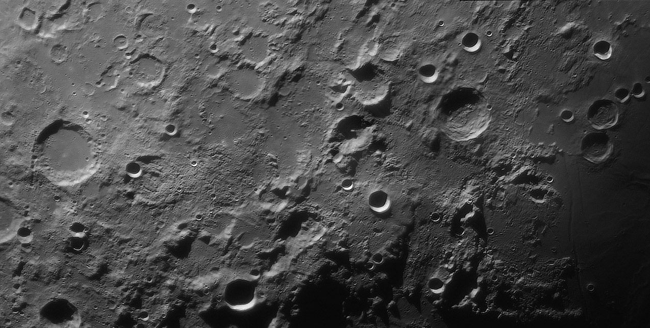
image by Maximilian Teodorescu, Dumitrana (Ilfov), Romania
|
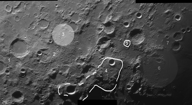
Looking at an image from an unusual perspective allows different things
to be recognized. In this panoramic view by Max north is to the right,
and one thing that pops out is the elongated plateau (#4 in the annotated
image). This is part of the elevated rim of the Nectaris Basin and Mt
Penck is just off the bottom of the image near the bottom-most dash.
Kant is the shadow-filled crater and this elevated area is also informally
known to geologic mappers as the Kant Plateau. It does contain some
anorthosite and may be a part of the early crust uplifted by the Nectaris
impact. There are other numbered features here that I had planned to
describe but didn't get to - I suppose many of you can figure out what is
interesting about them.
Chuck Wood
Technical Details
September 25, 2013, 03:05 U.T. C 11 @F/25, 2x barlow, ASI 120MM,
IR-pass filter (685nm), 2000 frames out of 6000. Seeing: 5/10. Mosaic
of 3 images.
Related Links
21st Century Atlas charts 7, 11 & 12.
|
Yesterday's LPOD: A Bridge To Far, an Observation Quite Good
Tomorrow's LPOD: Planning a Trip


