June 27, 2014
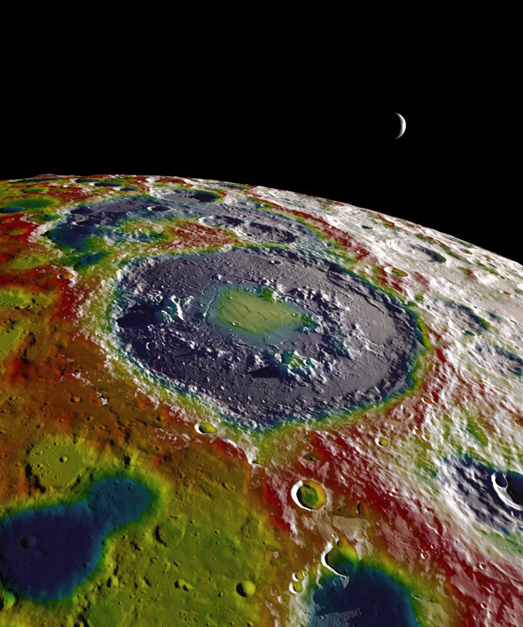
Red and Blue

image by Ernest Wright, NASA Visualization Studio at Goddard Space Flight Center
Here is a gorgeous mashup of LRO image, altimetry and derived gravity data. The feature is Schrödinger Basin near the South Pole on the far side. On the Moon, gravity and topography are closely correlated so the red of high gravity coincides with elevated topography. And the blue on the bottoms of nearby craters and the outer bench of Schrödinger are areas of low gravity or a gravity deficiency compared to the average (yellow). This is a free-air gravity map which means that corrections have not been made for topography. For one piece of landscape the gravity does not follow the topography - do you spot it?
It is the center of the Schrödinger Basin. The center is almost the deepest part but it is yellowish-green, there is an excess of gravity there. Why? Because the basin hosts a mascon, a concentration of mass probably due to an upward flow of denser mantle rocks into the lower density crustal rocks. This stunning image is from a new article in Geophysical Research Letters. Fortunately, this article is open access, which means that anyone can download it without subscribing to the journal. All science reports supported by taxpayers dollars should be open access. The article is about techniques, explaining how the authors improved significantly the quality of the model compared to prior gravity models, but it does not discuss the geology or geophysics at all. To do that requires the next step of analysis, which is constructing a Bouguer anomaly model that does take into account variations in topography. Once that is accomplished then any other anomalies that are not as strong as the mascon will become apparent.
Chuck Wood
Yesterday's LPOD: Half-Filled Trough
Tomorrow's LPOD: The End of Lunar Studies
COMMENTS?
Register, Log in, and join in the comments.


