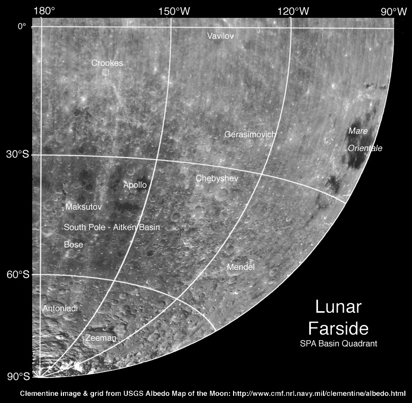
image from USGS Clementine mosaic, annotated by C.A. Wood
Earlier I created an orientation map of the NE quadrant of the farside to help me learn my way around. Since then I’ve published a S&T article (Jan, 2007) about the geology of the farside, but there is still no useful sketch map, so I continue with another quardrant. This one is the SW quadrant that contains the dark and deep part of the South Pole - Aitken Basin. Most the maria on the farside are within the floor of SPA. The other big patch of farside maria is Orientale, at the western limb. South of Orientale is a dark annulus of probable pyroclastic material. I wonder when there will be a good farside image map?
Technical Details:
One-quarter of a full Clementine mosaic compiled by the USGS.
Related Links:
Another farside image mosaic made from Orbiter IV and V shots exists, but is not labelled with names, yet - perhaps it will be someday.
Yesterday's LPOD: Magnificent Side View
Tomorrow's LPOD: Lunar Slide
COMMENTS?
Register, Log in, and join in the comments.


