Difference between revisions of "July 6, 2018"
(Created page with "__NOTOC__ =The Best Image Map of the Moon= Originally published April 9, 2009 <!-- Start of content --> <!-- ws:start:WikiTextHeadingRule:2:<h1> --> <!-- ws:start:W...") |
(No difference)
|
Latest revision as of 00:04, 6 July 2018
The Best Image Map of the Moon
Originally published April 9, 2009

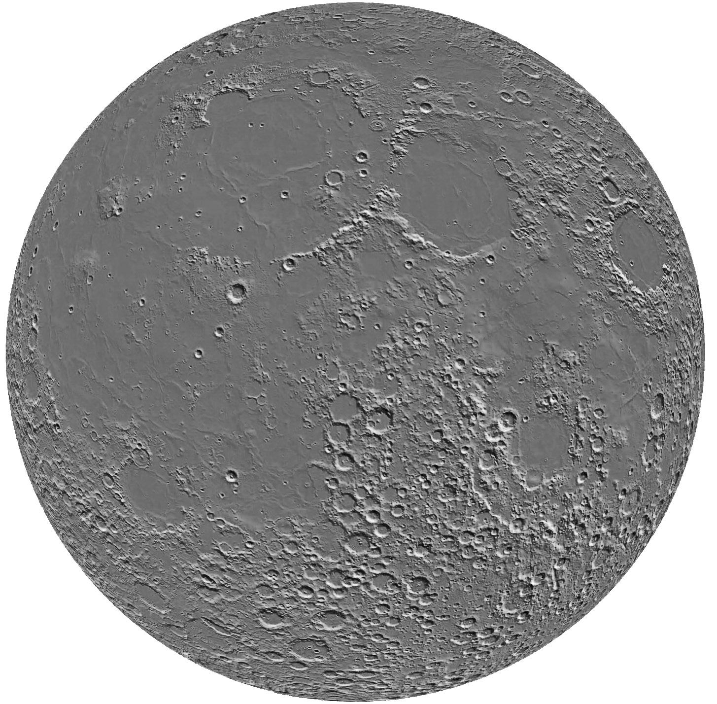
digital topography image map simplified from JAXA/Kaguya Image Gallery
This is a big image and worth every pixel. JAXA has recently released a significantly improved version of their earlier Kaguya topography
map of the Moon. The new map is based on enough laser altimetry data points (over 6 million) that when you suppress the colors that
represent elevation you get the best image map of the Moon that has ever existed. And the elevation data is still there as indicated by
shading. This wonderful image map reveals may interesting subtle topographic anomalies that I am sure JAXA scientists will be studying.
For example, notice that the Marius Hills and its adjacent giant swell are an elevated area comparable to the Aristarchus Plateau. I didn't
know there was a huge swell between Triesnecker and Hyginus. The Gardner Megadome really is an unusual feature. Is that a long trough
on the southwest side of Serenitatis? Why? This quick tour of a fantastic new resource will transform our ability to ask and hopefully answer
important new questions about the Moon. This is presumably not the final topo image map that Selene/Kaguya will produce so we can
look forward to more detailed depictions of an unknown moon.
Chuck Wood
Related Links
Laser Altimetry instrument
Yesterday's LPOD: Big Backside Basin
Tomorrow's LPOD: A Bucket of Darkness
COMMENTS?
Register, Log in, and join in the comments.


