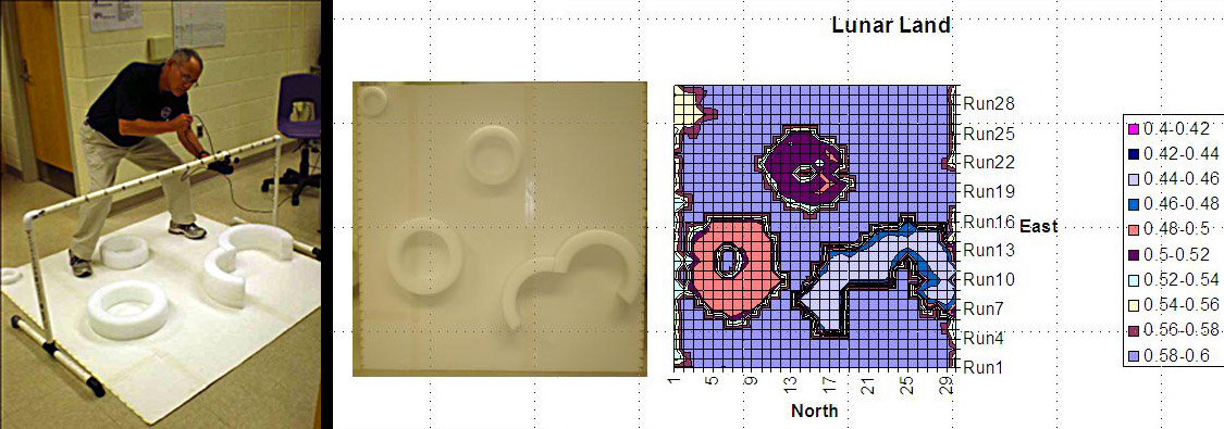
image by Don Higdon and Susan Hoban
The Lunar Reconnaissance Orbiter, scheduled to launch in October 2008, will carry the Lunar Orbiter Laser Altimeter (LOLA). LOLA will produce topographic maps of the Moon using a LIDAR ranging system. We have developed a hands-on activity for middle and high school students that uses an ultra-sound motion detector to simulate LOLA LIDAR mapping. This activity is presented in the context of a larger module, which involves a simulated lunar search-and-discovery mission, using simple robots equipped with various sensors. The students use the topographic map that they produce to determine the path that their robot will traverse through Lunar Land, a 150 cm-square mock-up (above left) of a surface with obstacles (craters!?) of various heights. The figure above shows, in the center, Lunar Land, and on the right is the topographic map of Lunar Land generated using the ultrasound motion detector. This lesson offers an opportunity to engage students in an activity analogous to that which real lunar scientists might do, and provides an opportunity for a discussion of lunar science, fundamentals of measurement (including measurement uncertainty), spatial resolution in the context of remote sensing, and graphical representation and analysis of data, for starters. This effort is supported through the NASA Exploration Systems Mission Directorate Education.
Don Higdon and Susan Hoban
Technical Details
Here are detailed instructions for this activity.
Yesterday's LPOD: New Perspective, Old Image
Tomorrow's LPOD: Equal Rims?
COMMENTS?
Register, Log in, and join in the comments.


