June 3, 2011
Ups And Downs but Are They Sound?

image by " rel="nofollow Maurice Collins
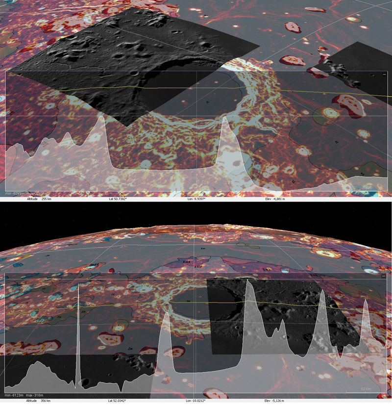
Maurice, our intrepid lunar imaging explorer, is apparently one of the few to try out the new " rel="nofollow Iliads software mentioned in the LPOD of [/May+16%2C+2011 May 16]. The monthful Integrated Lunar Information Architecture for Decision Support downloadable program allows combining of various data sets - here, Maurice used the LRO slope map and the USGS geology map as background with a few Kaguya images draped here and there, and a topographic cross-section passing across Plato. The top image shows a transect running approximately NE to SW, revealing a flat floor for Plato, which is significantly higher than nearby Mare Imbrium. The lower image is more surprising for it displays a significant down slope of Plato's floor from east to west. There doesn't seem to be a scale bar for the altimeter trace but estimating from the altitude of Plato's east rim above its floor (~2.5 km), the western side of Plato's floor is about 200 m lower than the east side. Is that true? Possibly, but some of the other topography here looks questionable, especially the unimposing " rel="nofollow hillock to the west that maps as a towering spire on the altimetry. We all need to look closely at Iliads to understand any limitations or errors in the software or data. It looks like it can be a very good analysis tool, once it is better understood.
" rel="nofollow Chuck Wood
Related Links
Rükl plate 3


