Difference between revisions of "January 16, 2009"
| Line 16: | Line 16: | ||
Richard's astro [http://www.astrofotografie.nl/index.htm website]<br /> | Richard's astro [http://www.astrofotografie.nl/index.htm website]<br /> | ||
<br /> | <br /> | ||
| + | <p><b>Yesterday's LPOD:</b> [[January 15, 2009|Historical Footnote, 40 Years Late]] </p> | ||
| + | <p><b>Tomorrow's LPOD:</b> [[January 17, 2009|Pinging the Poles]] </p> | ||
<hr /> | <hr /> | ||
Revision as of 23:20, 4 February 2015
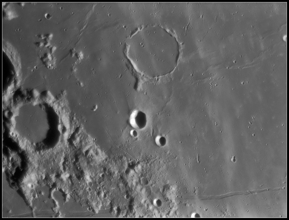
Pi in the Sky

image by Richard Bosman
Apollo 10 astronauts called the Hypatia Rille US 1. Perhaps if they had been reconnoitering a landing further west the long Hesiodus Rille (bottom) would have been a landmark that they might have called US 10 after the interstate freeway that stretches across the southern USA, passing near NASA's space centers Cape Canaveral to Stennis, Marshall, Johnson, White Sands and JPL. North of this lunar freeway Richard's fine image reveals a narrow rille between Kies A and Mercator. Two other smaller rilles or close crater chains are also in the image, but the star is Kies Pi, the famous dome just west of the flooded crater Kies. We have been here recently but every image suggests new questions and interpretations. It looks like the crater pit on Pi is not exactly centered, and there are a number of similar sized craters nearby. Is it possible the pit is not volcanic but a chance impact?
Chuck Wood
Technical Details
Jan 6, 2009 at 20:57 UT. C11 @f25 + DMK31 + red filter.
Related Links
Rükl plate 53
Richard's astro website
Yesterday's LPOD: Historical Footnote, 40 Years Late
Tomorrow's LPOD: Pinging the Poles


