December 4, 2011
Map of the Moon

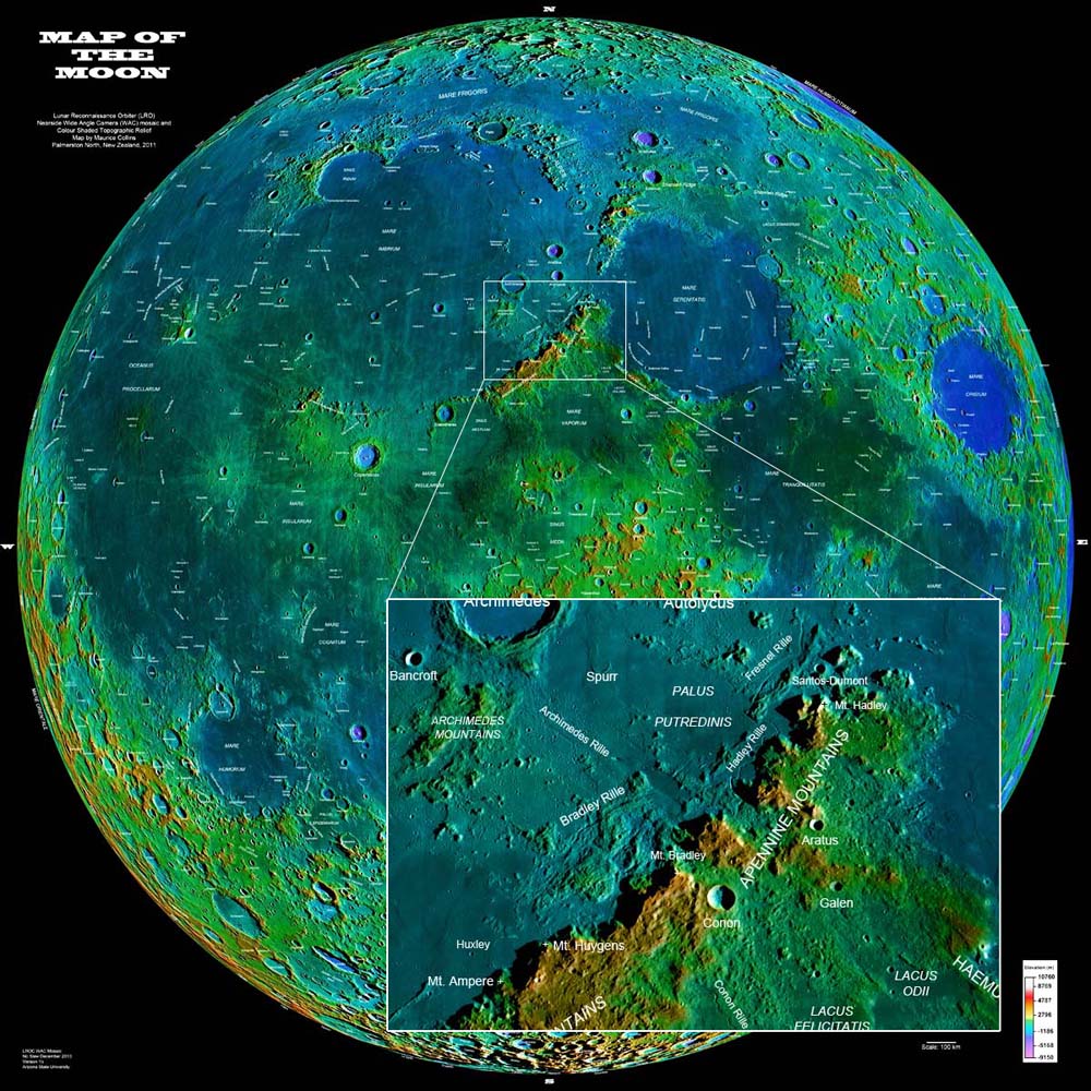
Lunar Map by " rel="nofollow Maurice Collins Using " rel="nofollow LRO WAC mosaic and " rel="nofollow Topo color mosaic. Click on image for a full-sized version.
Over the past few months I have been working on creating this Map of the Moon (fullsize is 5350x5350px image, 4.56MB in size) using the " rel="nofollow LRO nearside mosaic combined with the new " rel="nofollow WAC color shaded relief maps just released by the LROC team. The labels have all been added by hand over the past few months, guided by LTVT nomenclature and other atlases. The color shading of the WAC I think gives more information than the straight grayscale image and depicts the elevations just as in the color shaded relief but now with more details on the surface thanks to the underlying WAC mosaic. There is some loss of information in the shadows however. The insert shows is an almost full-sized view of what the map shows in the Apennine region. I am hoping it will be of use to amateur astronomers and lunar geologists for a quick reference to the major craters and features on the Moon.
" rel="nofollow Maurice Collins
Technical Details
Created in Photoshop CS-4 by using the Grayscale " rel="nofollow WAC_GL_000 mosaic changed to RGB and overlaid with the " rel="nofollow Color shaded topo and using blending mode "colour". Labels added with text tool.
Related Links
Shaded Color WAC mosaic:
" rel="nofollow http://wms.lroc.asu.edu/lroc/global_product/color_shaded_relief
WAC Nearside mosaic:
" rel="nofollow http://wms.lroc.asu.edu/lroc_browse/view/WAC_GL000
Maurice's LTVT Farside map:
http://the-moon.wikispaces.com/Maurice+Collins%27+Farside+Map
Direct link to this Map of the Moon:
http://the-moon.wikispaces.com/Maurice+Collins%27+Nearside+Moon+Map


