Difference between revisions of "August 19, 2004"
| Line 10: | Line 10: | ||
<table width="80%" border="0" align="center" cellpadding="8"> | <table width="80%" border="0" align="center" cellpadding="8"> | ||
<tr> | <tr> | ||
| − | <td><div align="center" class="main_sm">Image Credit: [http://www.lpi.usra.edu/research/lunar_atlases/ Consolidated Lunar Atlas/Lunar & Planetary Institute]</div></td> | + | <td><div align="center" class="main_sm"><p>Image Credit: [http://www.lpi.usra.edu/research/lunar_atlases/ Consolidated Lunar Atlas/Lunar & Planetary Institute]</div></td> |
</tr> | </tr> | ||
</table> | </table> | ||
Revision as of 21:40, 21 January 2015
A New Dome?
Image Credit: Consolidated Lunar Atlas/Lunar & Planetary Institute |
|
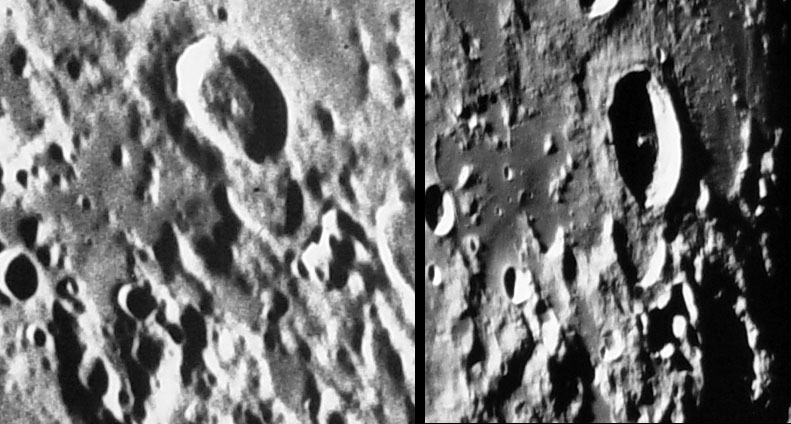
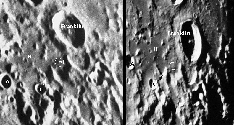
A New Dome? The northeast region of the Moon, beyond Serenitatis and north of Crisium is a region of discomfort. Its a wild place with the confusion of the Taurus Mountains and similar unstructured but unnamed chaos between Atlas and Cleomedes. Earlier this month I mentioned that the crater Franklin was worth examining because of dark patches on its floor. While following my own advice I discovered what may be an unreported dome just southwest of Franklin. The sunset image on the left is from the classic plate Lick 175, taken in 1938 and still one of the best images of the Moon's eastern limb. The possible dome (circled on the mouseover) is hemispherical, about 13 km wide with a well defined base and apparent central pit. The dome also has a darker coloration than the adjacent terrain. It looks like a classic dome. But now look at the higher resolution sunrise image on the right taken with the Catalina Observatory 61". The dome isn't gone, but the discovery would not have been made on that image because the structure looks like a non-consequential hill with a central hill rather than central pit. The 61" image does reveal that this area has a smooth, dark surface looking like mare lavas so a dome would not be unexpected. Lunar Orbiter did not do a good job of photographing this region of the Moon, but one image shows the putative dome area to have two small hills, a fresh impact crater and a number of subdued pits. Because of the relatively high sun typical of Lunar Orbiter IV images the dome itself can not be detected. I just wrote, "the dome itself," but it is too early to apply that classification with any certainty. This is another case where excellent, high resolution, low sun amateur images are needed to confirm - or deny - the interpretation. Technical Details: Related Links: Tomorrow's LPOD: Humor More My Fault |
Author & Editor: Technical Consultant: A service of: |
COMMENTS?
Register, and click on the Discussion tab at the top of the page.


