February 8, 2012
Chinese Moon

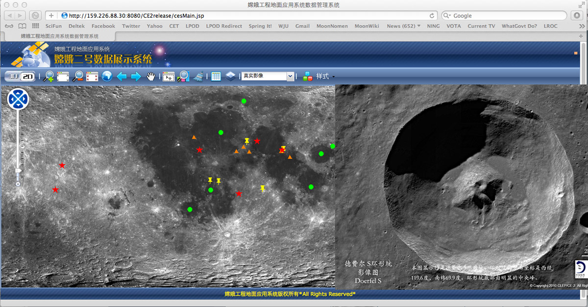
map image from Site whose name I can't find and crater inserted from GRAS Lunar Exploration Data Release System
China has an ambitious lunar exploration program that may lead to humans returning to the Moon in the next decade or so. As with Apollo a generation ago, Chinese human missions are being preceded by orbital and soon robotic lander missions. And now without much notice a large global map has been released based on imaging from the Chang'e 2 lunar orbiter. A Google Earth type map interface allows all areas (within +/-60° latitude) to be examined under various magnifications. Recent press releases claim that this is the highest resolution global map of the Moon but it is not clear if it is better than the LRO WAC mosaics. Another website has released topographic maps derived from the laser altimeter on Chang'e, and a handful of very nice images such as this one of the crater Doerfel S on the farside beyond Bailly. S is a fascinating feature with large ponds - lakes, really - of impact melt on the floor, and a massive central peak with a crater pit right on the summit. In the old days this would be explained as a chance positioning of an impact crater but that doesn't seem likely. A volcanic origin for the central peak is also unlikely because we firmly understand that central peaks form by rebound following an impact. So perhaps there is some other explanation for the pit. On Mars and some icy satellites of the Jovian planets the ice melts during an impact and the center of the rebounding central peak collapses. But it is very unlikely that there are buried layers of ice under the Doerfel S crater. Every lunar mission from every country provides new data leading to new understanding and new questions.
Chuck Wood
Thanks to DarkPhoenix of vBulletin and yaohua2000 of unmannedspaceflight.com for links to these websites.
Yesterday's LPOD: The Missing Hook Mystery
Tomorrow's LPOD: Splattered
COMMENTS?
Register, Log in, and join in the comments.


