July 28, 2014
Quantified Mountain
image by Jocelyn Serot, France
 |
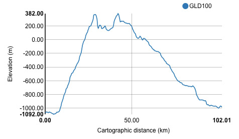
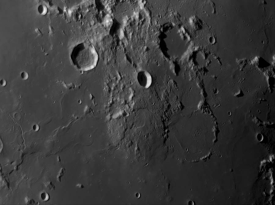
Ten years ago I proposed that a large comical hill south of the simple crater Gardner was a new type of feature, a megadome - a large volcanic mountain that even had a summit depression, perhaps a caldera. Now, thanks to the ease of making topographic transects with QuickMap we can quantify that interpretation. This cross-section goes from the upper left of the megadome diagonally towards the mid-right side, passing through the summit caldera. The mountain is about 100 km across and nearly 1.4 km high. This cross-section suggests a steep mountain but the vertical exaggeration is about 100 to 1, so this a gentle dome. The central depression is about 13 km wide, and it is roughly 150 m deep. In fact, it looks likely that there are at least two calderas, the center one just measured and another one to the north with a well-defined curved eastern rim. If this truly is a volcanic mountain, it is probably a large shield volcano, comparable in width to the island of Hawaii.
|
COMMENTS?
Click on this icon File:PostIcon.jpg at the upper right to post a comment.


