September 17, 2012
Find the Big Crater
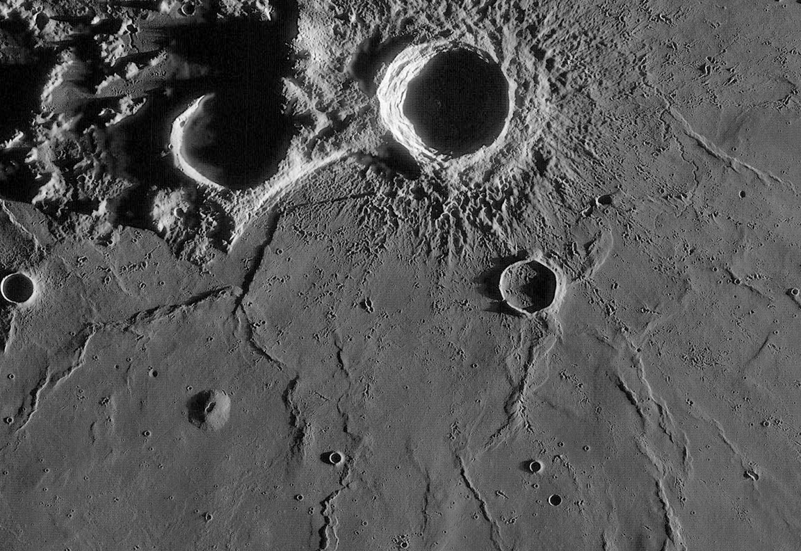
this is a piece of the LRO WAC mosaic processed by Maurice Collins, New Zealand
The abrupt scarp extending from Aristarchus pass the southern rim of Herodotus has always lacked a convincing explanation. But one was offered last year that I only stumbled upon today. Based on LRO altimetry data (LOLA) John Mustard and 11 coauthors proposed that the scarp was part of the rim of a largely covered impact crater about 110 km in diameter. They informally called the crater South AP, meaning south of the Aristarchus Plateau. In the small image at left I drew a circle through the scarp and the curved mare ridge extending south of Aristarchus F, the flat-floored crater south of Aristarchus. Two narrow mare ridges at the bottom of the image stop at the likely rim boundary, and on the west a larger ridge stops just inside the nominal circular rim boundary. Perhaps the ancient crater somehow interferred with the forces that formed the ridges. John and his team propose that South AP was the first feature to form in this area, but at least its northern side impacted into already existing high terrain, that is why the scarp is visible. Next, they propose that the Imbrium Basin formed, ejecting considerable amounts of debris right here at the basin's edge. Lavas from Procellarum and Imbrium surrounded the plateau, and at some point Herodotus and Schröter's Valley formed, along with the pyroclastic eruptions from the Cobra Head, and late stage Procellarum lavas continued to embay the plateau. Finally, about 400-500 m.y. ago the Aristarchus impact occurred. The report by John's group points out that the formation of South AP brought deep, pre-Imbrium rocks to the surface rocks, and was itself filled by Imbrium ejecta, lava flows and pyroclastics. When Aristarchus smashed into the rim of South AP it excavated this diverse collection of rocks, accounting for the streamers of different colored (on multispectral images) material, that we amateur astronomers have observed as bands on the walls of Aristarchus.
A Few More Comments
Positing that an uplift existed before the formation of the Imbrium Basin disagrees with my bias that the Aristarchus Plateau's existence is related to the basin. Perhaps the Plateau did form in association with Imbrium, and South AP formed after the basin, but before the lava flooding. That would be consistent with most of the observations above. And I can't help but wonder if the conspicuous dome exists because fractures along South AP's rim allowed magma to reach the surface there.
Related Links
Rükl plate 18
Mustard et al (2011) Compositional diversity and geologic insights of the Aristarchus crater from Moon Mineralogy Mapper data (PDF) . JOURNAL OF GEOPHYSICAL RESEARCH, VOL. 116, E00G12, doi:10.1029/2010JE003726, 2011.
COMMENTS?
Click on this icon File:PostIcon.jpg at the upper right to post a comment.


