April 26, 2024
Hip-Hip-Hippalus
Originally published January 6, 2014

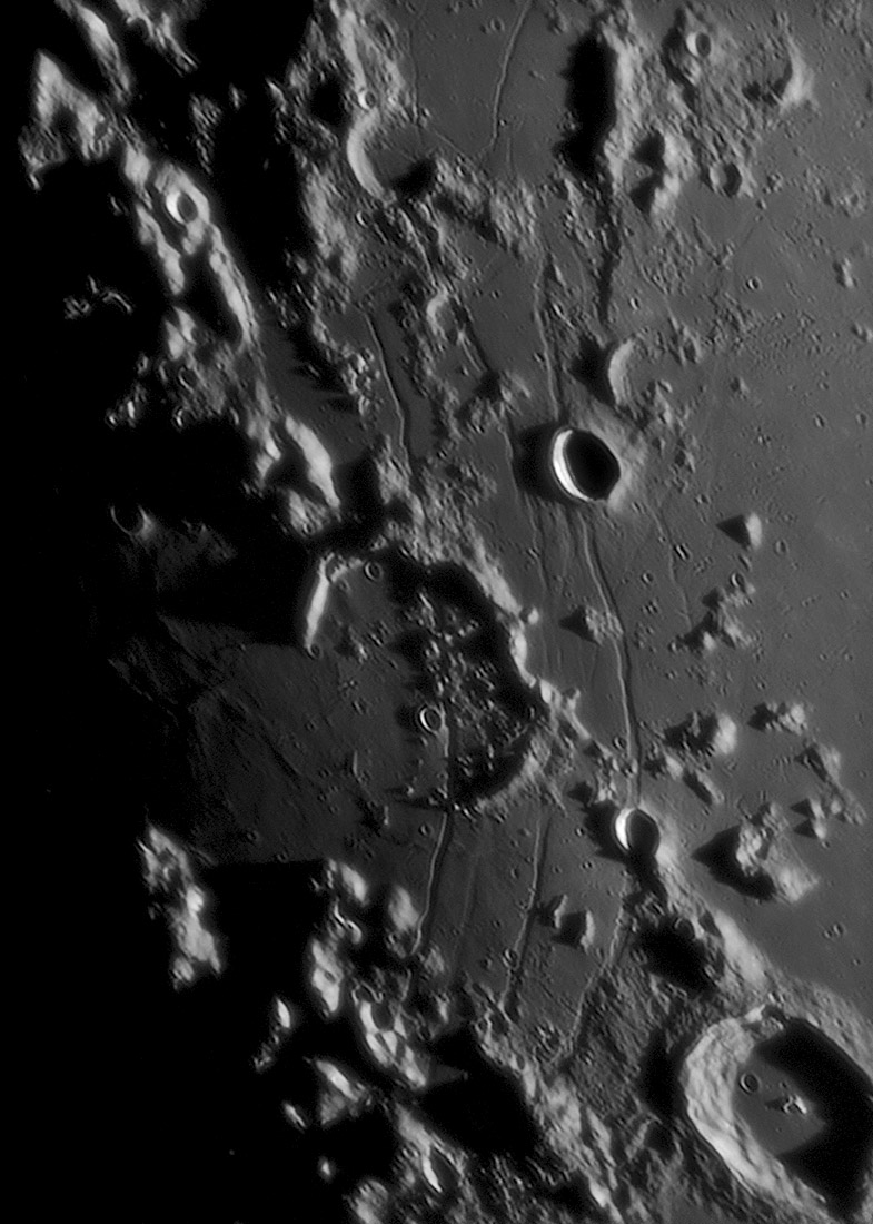
image by Philippe Tosi / E.Rousset / JL Dauvergne, Pic du Midi Observatory, France
Remember the rille segments in front of the Apennine Mountains? This is what they may have looked like before inundation by lavas. In fact, just saying that points out a difference compared to these circumferential Hippalus Rilles on the east side of the Humorum Basin. The Imbrium Basin circumferential rilles cut debris slumped from the basin's upraised rim, but mare lavas cover the rilles, so some volcanism occurred after basin subsidence. At Humorum, the main basin subsidence must have taken place after nearby lavas were emplaced and hardened because the subsidence-induced fracturing cut through the lavas. And here at the east side of Humorum, the fracturing created 3 or 4 rilles spread over a horizontal distance of about 50 km, whereas at Imbrium the exposure is less good but only 1 or 2 rilles are seen across about 10-20 km. I do not know the explanation for these differences, not to mention the very thin rilles on the west side of Tranquillitatis for a different variety. I need to dig out a 35 year old theoretical study of concentric rilles to look for reasons for the differences.
Chuck Wood
Technical Details
C.14 + skynyx 2.1 m + basler ACA 1300 + barlow 1.8x + red filter; process by AS2, CS5 and photomatix pro with tone mapping.
Related Links
21st Century Atlas chart 23.
Yesterday's LPOD: Out On a Gaussian Limb
Tomorrow's LPOD: A Rare Capture
COMMENTS?
Register, Log in, and join in the comments.


