May 31, 2022
Sharper Still
Originally published July 8, 2012

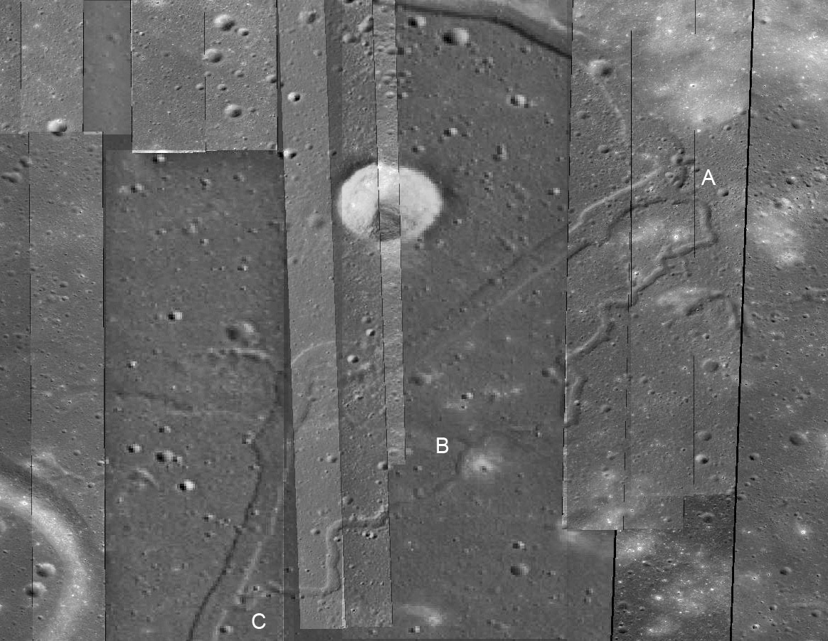
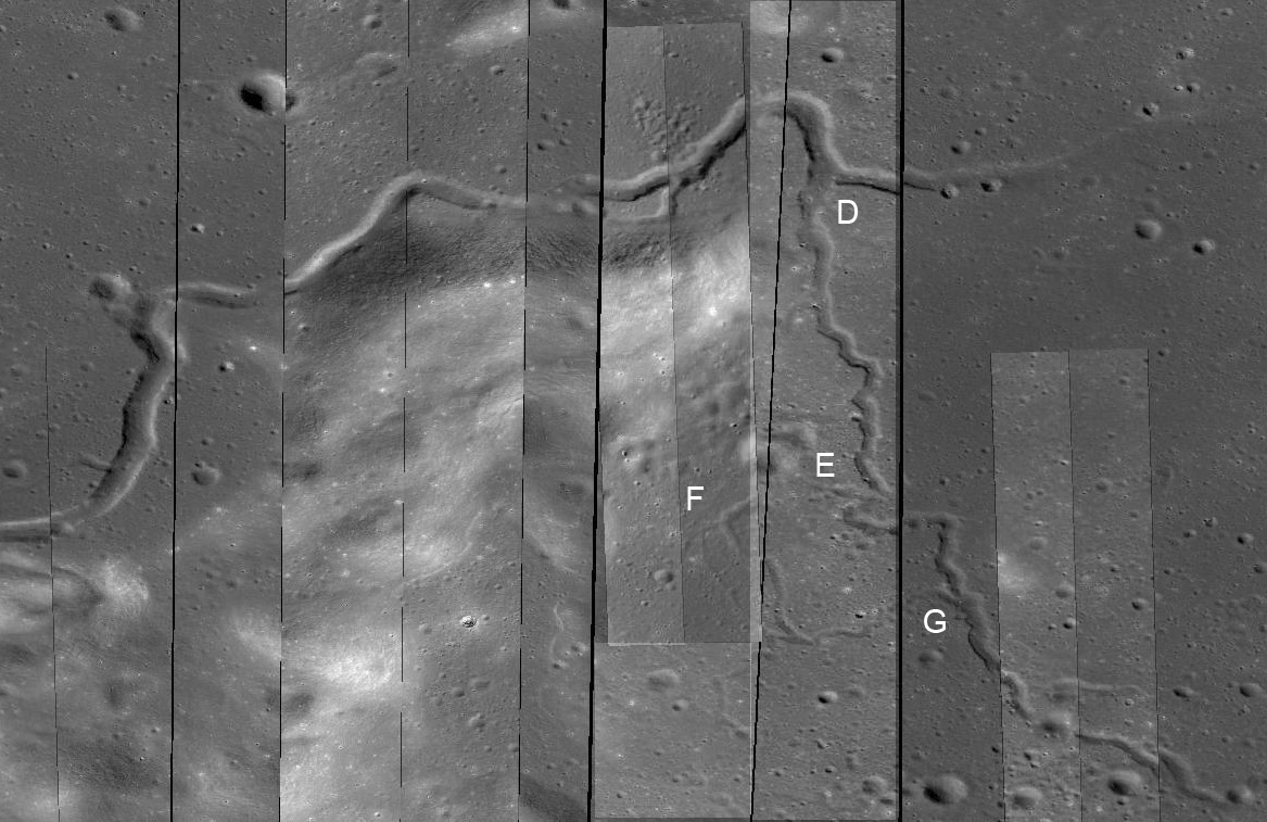
images from LRO QuickMap (NASA/Arizona State University)
Yesterday's LPOD was an oblique overview of the northern end of the Sharp Rille. Now we look straight down on two pieces of it to learn more. The images are from the LRO QuickMap with great enough zooming in that the Narrow Angle Camera (NAC) images are superposed on the normal WAC view - I have tweaked some of the NAC frames to bring them closer in tone to adjacent ones. The large crater above is ~3 km wide. In the mid-zone of yesterday's image at #4 the rille was harder to see and apparently crossed a mare ridge. With this NAC view the main ridge crosses the image east to west where the B is, and another hilly area is at A. The Sharp Rille clung to the mountain, curved, and at A climbed the 15-20 m high ridge. I thought that the small more sinuous rille that took off at A might have been a lower pass that the lava overflowed to, and that might be what happened because the floor heights of the main rille and the small one are about the same. Both rilles continued to flow towards the south, passing through/over another 15-20 m high ridge at B. Finally at C the smaller rille rejoined the wider one. Lava is a liquid and flows which ever way downhill is. But lava channels/rilles differ from flows of water because water flows across a pre-existing landscape and rilles carry the lavas that spreads laterally from them to create the landscape. So these lavas were originally flowing at a lower elevation and over time built up up their thickness.

This is the area of #2 in yesterday's LPOD. This is an earlier channel from the Sharp vent that flowed around the 500-600 m high hilly mass and at D split into two rilles. Probably the rille that goes from D towards E was the earlier one that was later abandoned and then the lava flowed to the right creating that channel, which soon becomes just a 15 m deep winding trough. The D to E to G rille had a breakout itself, with a smaller channel breaking out to the left at E and rejoining the main rille at G. And like the nested Russian dolls the small E to G channel had a breakout at F with a smaller rille going its own way for about 4 km before it joined its slightly larger parent. The complex patterns of volcanic flows here remind me of the conclusion that volcanologist Don Swanson made about the Mauna Ulu eruption in Hawaii that he had monitored nearly daily for 4-5 years in the 1970s. Don said that if a future geologist found the multiple overlapping flows in the geologic record it would be nearly impossible to figure out exactly how it had formed.
Chuck Wood
Related Links
Rükl plate 9
Yesterday's LPOD: A Sharper Tale
Tomorrow's LPOD: Why Does Plato Gamma Exist?
COMMENTS?
Register, Log in, and join in the comments.


