October 21, 2009
Not the Moon

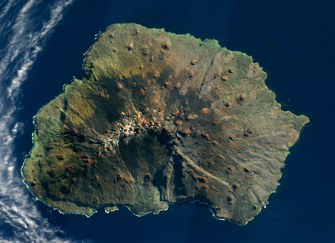
image from NASA Earth Observatory
Back in the late 1990s I directed VolcanoWorld, a NASA-funded website about volcanoes on Earth, and a little about those on other planets and moons. Within three years VW was pulling in 4 million visitors/yr and was one of the largest science sites on the web (by comparison LPOD attracts about 1/10 that number, but has no funding nor staff). When I saw this image last night I knew it was too glorious to not use for LPOD. Marion Island is about 19 km wide and 1200 m above sea level, but the volcano rises 5 km above its base on the Southern Indian Ocean sea floor. The entire mountain is a basaltic shield volcano - like those of the Hawaiian Islands - and explosions creating the ruddy-hued cinder cones may have been powered by the interaction of rising magma with seawater. The Moon has a number of shield volcanoes - the domes - but they typically have lower slopes than terrestrial shields. The Moon typically doesn't have cinder cones (volcanic dark halo craters like those in Alphonsus and Atlas are gravity-modified equivalents), but the Marius Hills have three times as many cones as Marion Island. If you check the full res version of the image you see a few lava channels, what we call sinuous rilles on the Moon.
Chuck Wood
Technical Details
May 5, 2009. EO-1 satellite, Advanced Land Imager (ALI).
Related Links
Check this wide angle view showing amazing cloud free zones as the topographic highs of Marion Island and Prince Edward Island block the clouds.
Yesterday's LPOD: Hop, Skip & a Bounce & a Bounce & a Bounce & a Bounce & a Bounce & a Bounce
Tomorrow's LPOD: The Other Apollo
COMMENTS?
Register, Log in, and join in the comments.


