October 20, 2008
62 Years Later

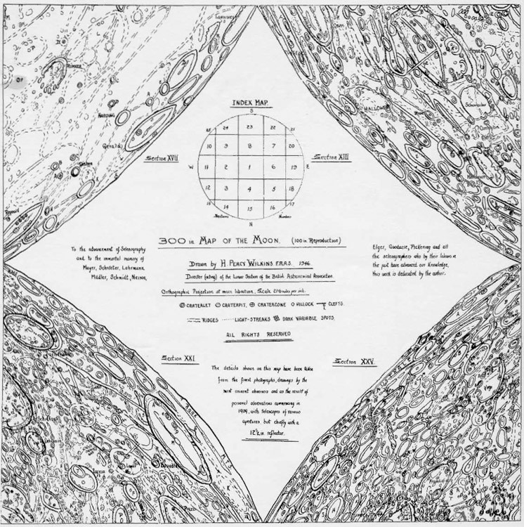
1946 Wilkins map from The Astronomical Society of Las Cruces
Looking like a pair of double curtains opened up, this title page for a 1946 version of H. P. Wilkins' famous 300" map is now available online. Members of the Astronomical Society of Las Cruces (Rich Richins and Dave Dockery) have scanned in the reduced to 100" diameter map originally published in The Strolling Astronomer in the early 1950s. This is the map that ultimately appeared in Wilkins and Moore The Moon of 1955, but this is a draft version with hand written names and sheet titles. Just looking at these four extreme corners you can see that the northeast corner (upper left) looks unfinished because it has far more white space and less detail. Actually that is the way the Moon is, where Oceanus Procellarum extends nearly to the limb. Other than here most of the limb is highlands terrain with lots of craters. I thank the ASLC - I plan on printing this out to add to my still growing collection of lunar maps and books.
Chuck Wood
I am at JPL for a Cassini meeting and may not have time to do LPOD the next night or two.
Yesterday's LPOD: Bumpy, Lumpy And Where?
Tomorrow's LPOD: Fractured, Tilted And Flooded
COMMENTS?
Register, Log in, and join in the comments.


