November 17, 2013
Flooded Old Craters

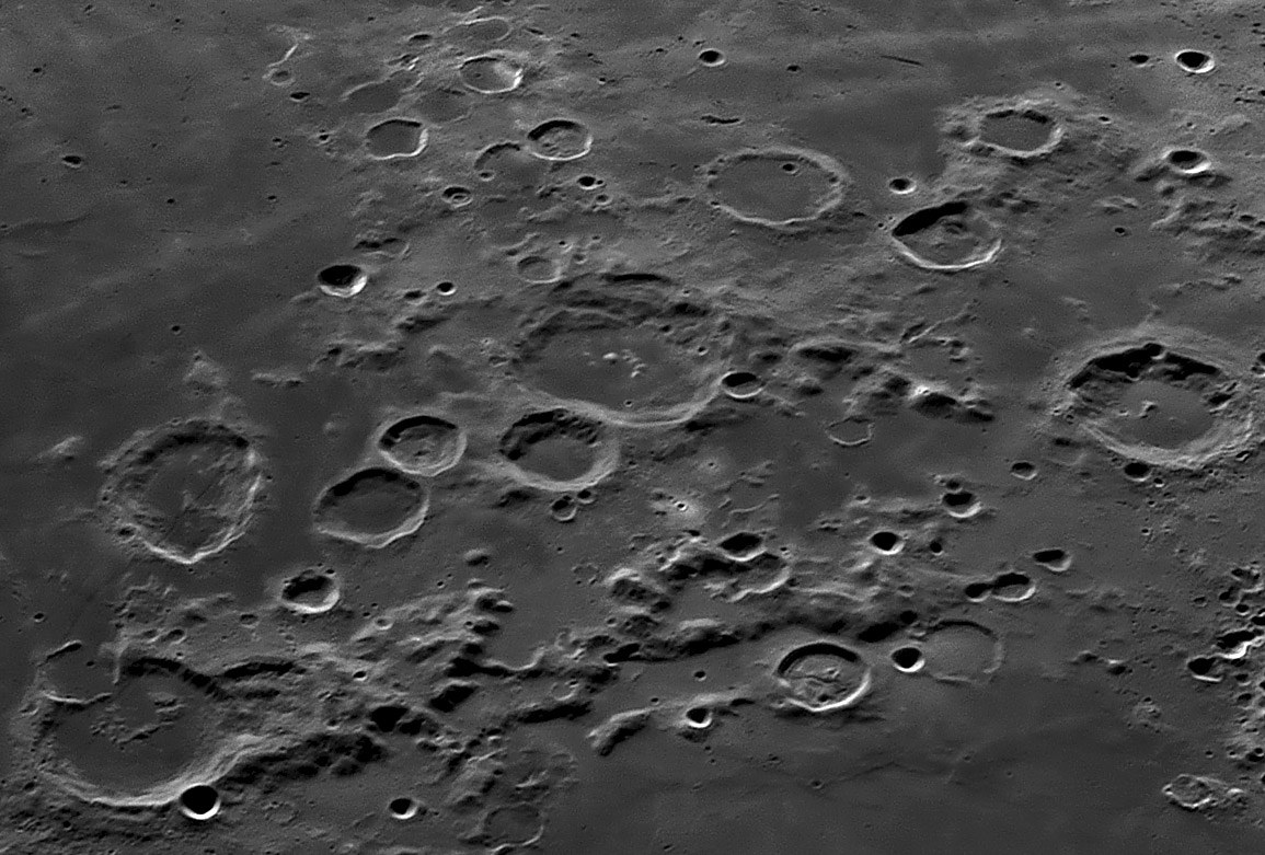
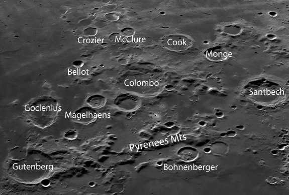
east up image by Jose Cabello, Málaga, Spain
 |
Do you notice anything about the craters here? They are all (almost) floored with lava, from Gutenberg to Santbech. Most of these craters are in the moat region between two rings of the Nectaris Basin - one ring is marked by the Pyrenees Mountains and the other - which is the continuation of the Altai Scarp - passes through Cook. Basin ring moats are often floored with light-hued smooth material like that between Santbech and Bohnenberger. But a lot of the flooding here is from dark mare lavas. That is probably because this eastern side of the Altai rim is five kilometers lower than the western side. Perhaps the much lower rim is due to the Nectaris Basin forming partly on an already low area on the east - the ancient Fecunditatis Basin. It is intriguing that a thumb of high older terrain juts eastward, isolating the mare near Petavius B from the main Fecunditatis lavas further north. McClure, Crozier and three or four other flooded craters are in this thumb (as is the concentric crater Crozier H).
|
Yesterday's LPOD: Pythagoras South
Tomorrow's LPOD: Frost Moon Rising
COMMENTS?
Register, Log in, and join in the comments.


