August 28, 2018
Convergence
Originally published June 15, 2009

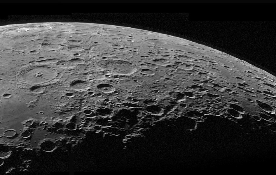
image by Jim Ferreira, Livermore, California
Just south of Petavius is the Snellius Valley, which here can been seen stretching its entire 600 km toward the limb. Further south is the Rheita Valley, and many less conspicuous linear features are in between. All of these are generally radial to the center of the Nectaris impact basin. The two named valleys are giant secondary crater chains, and most of the other radials are probably due to crustal fracturing associated with the impact. The amazing thing is the such features are clustered here to the southeast of the basin and a few more are toward the south. There could have been similar radials in areas covered by maria, but there aren't any to the west where ancient crust remains. The USGS also mapped most of the Nectaris Basin ejecta in this direction. I propose that basin secondary chains are the megascale equivalent of crater rays, and that these suggest that Nectaris was an oblique impact with the projectile coming from the north-northwest.
Chuck Wood
Technical Details
C9.25 @ f/10 and DMK21.
Related Links
Rükl plates 68 & 69
Jim's entire mosaic
Yesterday's LPOD: Neison Reborn
Tomorrow's LPOD: Out On a Gaussian Limb
COMMENTS?
Register, Log in, and join in the comments.


