April 12, 2009
Mount Sirsalis

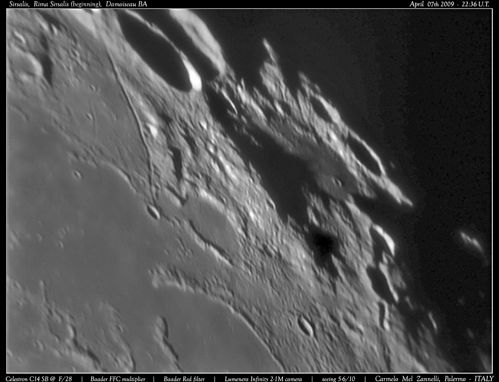
south up image by Carmelo Mel Zannelli, Palermo, Sicily - Italy
Each illumination condition reveals something new to understand. Carmelo's low Sun shot of the bright rimmed crater Sirsalis and its famous rille reveals an unusually high mountain just to the north. This mountain is the highest part of the rim of a 91 km wide older crater Sirsalis Z. Nominally the floor of Z is the flat spot near the terminator. Looking straight down on the area shows why Z was identified as a crater - there is a crude circular enclosure with a low spot in the middle. But why is the east rim shown here so massive? Almost always an isolated massive mountain like this is part of an impact basin rim. This mountain is near the outer rim of Grimaldi Basin but is not part of that. Nor does it appear to be related to Orientale or the putative Gargantuan/Procellarum basins. This mountain is too conspicuous not to have been noticed by the classic map makers of the late 1800s. It does appear on Schmidt's map, but I don't see a letter near it. Neison's map seems to have a letter, perhaps a beta (in the old days Greek letters were used for elevations). So we have a possible name: Sirsalis Beta or maybe Mount Sirsalis, and someone will undoubtedly measure its height with LTVT; now all we need is to know why it exists!
Chuck Wood
Technical Details
See image margin
Related Links
Rükl plate 39
Carmelo's website - coming soon (but a nice title page already)
Yesterday's LPOD: Peach-Pod
Tomorrow's LPOD: Three Things To Notice
COMMENTS?
Register, Log in, and join in the comments.


