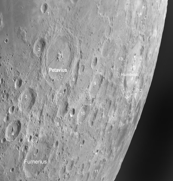
mosaic image by Павел Пресняков (Pavel Presnyakov), Kiev, Ukraine. In a possible OPAM the main craters could be named and others numbered with desciptions on the facing page.
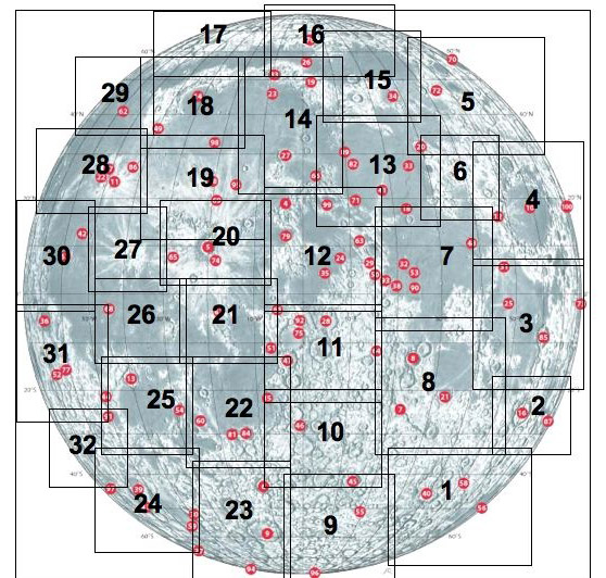
Is it possible to create a great Observer’s Photographic Atlas of the Moon (OPAM)? I have most of Moon maps and atlases that have been published over the last 100 years, and none is exactly the companion I want at the telescope. Let me mention three good ones, that each miss for my needs. The Hatfield Photographic Lunar Atlas has many excellent attributes: it is not bulky, but is big enough to show a decent size area of the Moon, it has 5-6 views of each field, and it has sketch maps that identify all the named and lettered craters. Its downsides are that the photos are low resolution, 5-6 photos are too many while observing, and the map is very hard to read. During the last 3-5 years I have experimented with many ideas for a really useful OPAM - here is a summary: It should be spiral bound, have a limited number (30?) of sheets (a compromise of a relatively large area and large image scale), use high quality photos, and unambiguously display names of all major features. The image above shows a possible layout of a 32 sheet atlas and an image of map #2. I find a number of problems with this possible atlas design, but you can tell me what you like and don’t, and what you’d like for your perfect OPAM.
Technical Details:
May 21, 2007. 10″ TAL-250K Klevtsov + EVS-135, b/w 1280×1024, 15fps; 200/1000 in Registax4.
Related Links:
This is just a piece of an excellent mosaic seen here.
Yesterday's LPOD: No Stratton
Tomorrow's LPOD: Bright Stuff

Boundaries of possible OPAM, shown on S&T’s map of the Lunar 100. Note that fields are meant to show a coherent geologic region and hence are of different sizes, but they would all be reproduced at the same scale. Opposite each map would be a page describing interesting features to oserve, as in a Norton’s Sky Atlas.
COMMENTS?
Register, Log in, and join in the comments.


