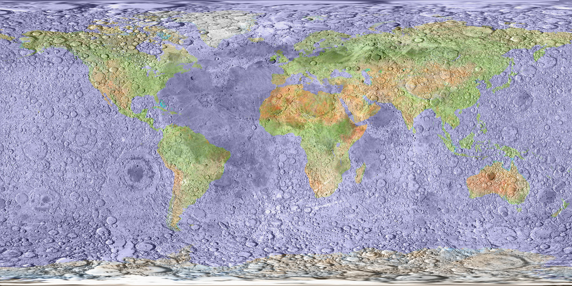
image from Henrik Bondo
Most of us have a comfortable familiarity with Mercator maps of Earth and a general awareness of lunar geography (or selenography to be correct). Henrik has now superposed a simplified map of Earth from NASA’s Visible Earth site onto the USGS airbrush drawing of the Moon from Map-A-Planet using a simple cylindrical projection so that each pixel corresponds to a point with the same selenographic/geographic longitude and latitude. This combined view is full of conceptual surprises about Earth! It is always a surprise that where most of LPOD visitors live – in the US and Europe – is so far north. My home in northern West Virginia has a latitude similar to the northern-most part of Oceanus Procellarum. And Henrik’s home in Denmark maps to the lunar Mare Frigoris, which he says is the way Denmark feels in the winter. It is fitting that most of the nearside maria fall in the Atlantic Ocean, and it is fascinating that the curve of western South American wraps around Orientale – could there be a connection? (No.) Henrik has also mapped this combination of worlds on a globe. Rotate the globe so it is centered on the exact farside of the Moon and you will see that that corresponds with the middle of the Pacific Ocean. It is sort of disappointing that the USA doesn’t drape over the center of the nearside of the Moon – I’d love to live in the pixel that corresponds to Copernicus, or even Linne!
Yesterday's LPOD: Two Weeks in Domeland
Tomorrow's LPOD: Saturation and Filling In
COMMENTS?
Register, Log in, and join in the comments.


