May 22, 2005
Domeland
Image Credit: Jim Phillips |
|
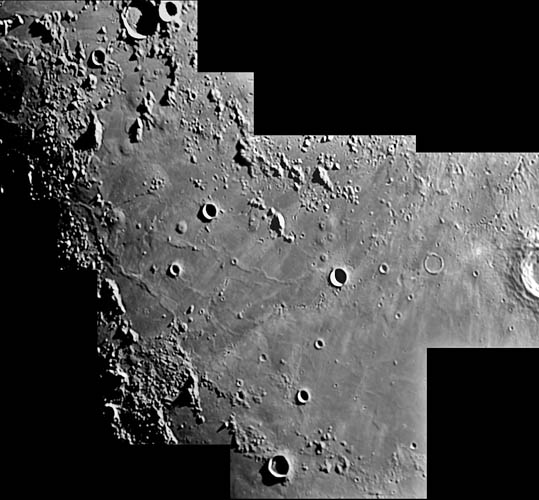
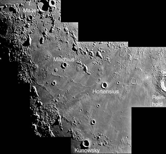
Domeland Selenographers are confident that lunar domes are small shield volcanoes, and that swells are perhaps a type of shallow laccolith (intrusion of magma just under the surface). But what we don't understand, except in a most rudimentary way, is why domes occur where they do. Domes are found in maria, especially near shores or other areas where the lava is thin. But why, for example, are there clusters of domes in areas such as northern Tranquillitatis and, as beautifully displayed here, the Domeland west of Copernicus? The way we will finally answer this question is by studying the spatial distribution of domes. Jim Phillip's fabulous mosaic is exactly the sort of image roadmap that is needed to discover and accurately plot the location of all the domes in a single area. This classic dome area contains many familiar domes such as the suite near Hortensius, the classic hemispherical and pitted Milichius Pi, and the clustering of domes and swells south of Tobias Mayer. But you can also see many other swells, including the giant one west of Milichius. In just looking at this mosaic I do not see any obvious geologic reasons for the domes being where they are - hopefully a clear plotting of their positions in relation to the Imbrium basin fractures and other volcanic features will provide clues. Technical Details: Tomorrow's LPOD: Snaky Rivers |
|
Author & Editor: Technical Consultant: Contact Translator: A service of: |
COMMENTS?
Register, and click on the Discussion tab at the top of the page.


