January 15, 2009
Historical Footnote, 40 Years Late
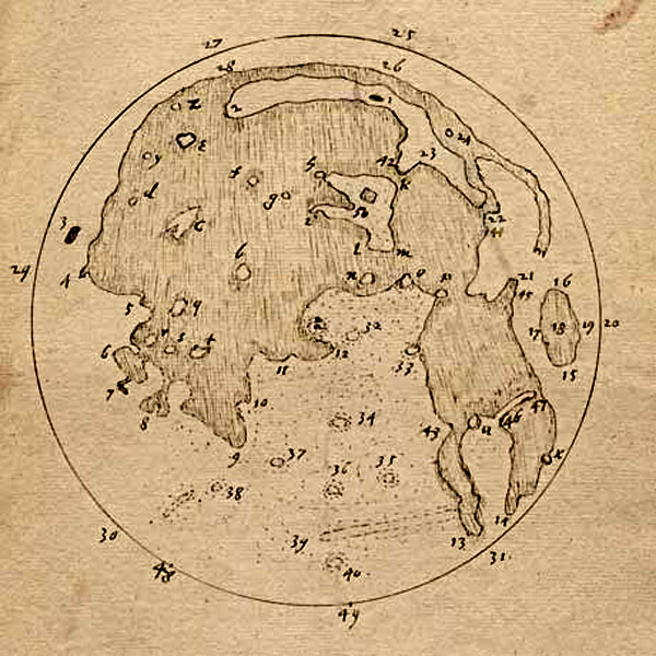
image from Chuck Wood
Obstreperous Comment
Here is a mystery for you - how did Harriot make the full Moon map above? It certainly was not compiled from his sketches, which are much poorer. In fact, this apparently later map (probably 1611 according to Whitaker) is what people hold up as being better than Galileo's drawings, when in fact, Harriot's early sketches were, to my eyes, worse. Admission of guilt: I haven't ready any of the specialist publications about Harriot.
Another Comment
The numbers and letters on Harriot's drawing were not keyed to names, but - Whitaker believes - were apparently only meant as positioning guides. The first map with nomenclature was drawn nine years earlier (naked eye) by the scientist WIlliam Gilbert - you can guess his nationality by the name he gave for Mare Crisium: Brittannia.
COMMENTS?
Click on this icon File:PostIcon.jpg at the upper right to post a comment.


