June 29, 2014
Rillzapopin
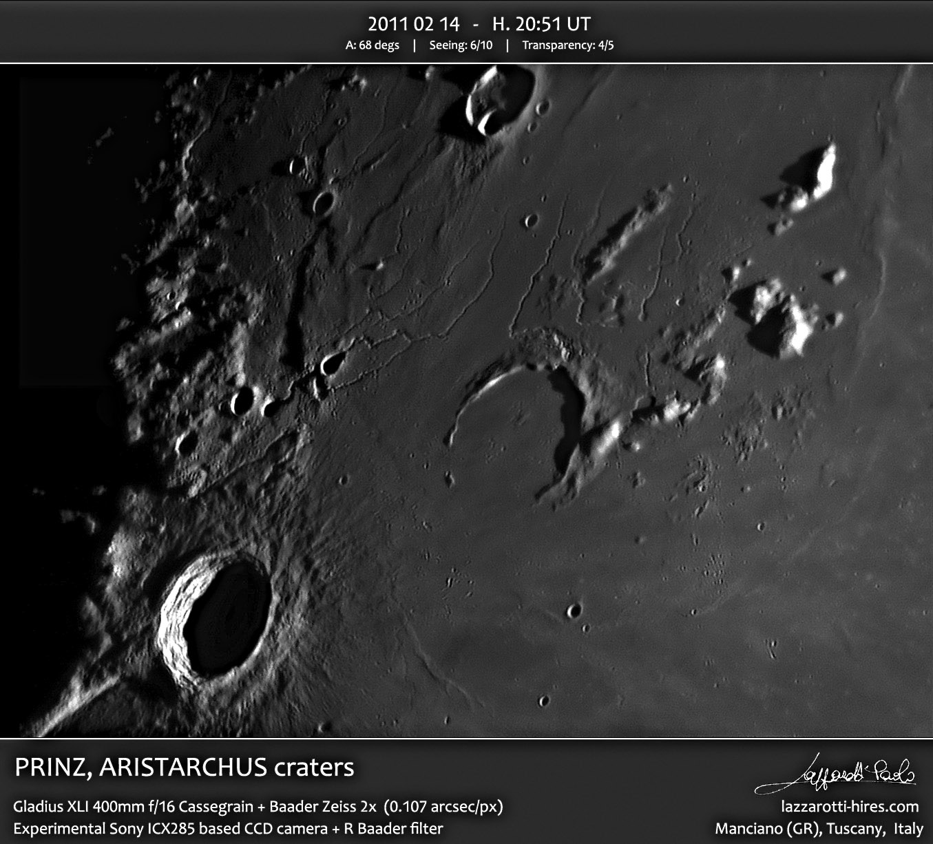
image by Paolo R. Lazzarotti
Rilles pop up all over this image. Well, that's not really true, for the rilles have two rather limited vent areas. The Aristarchus Rilles have vents along the eastern side of the Aristarchus Plateau (AP), which is more irregular than the sharply bounded western side. The second source of rilles is in the middle of the Harbinger Mountains (HM), just east,north--east of Prinz. Both the AP and HM regions are higher elevations than surrounding maria and are usually considered to be uplifted, rather than just high piles of lavas. Running a series of topographic transects over the LRO QuickMap image of the Harbinger area shows that the southern side rises more steeply up from the mare than the north side declines. In other words, not counting the individual Harbinger peaks, the Harbinger Plateau (HP) rises somewhat steeply on the south and then drops off in a long gentle slope to the north. All of the Harbinger/Prinz rilles had their vents near the areas of highest elevation and then lava gently flowed northward. The slow rate of flow is supported by the relatively high sinuosity of the rilles. When a fluid is on a gentle slope it flows this way and then that, following minor deviations in topography. Or as a friend said about a meandering river, It doesn't know what to do with itself. I can imagine that the Prinz vents are near the top of the HP because that is where magma pressure was highest. The reason for the concentration of Aristarchus Rille vents along the eastern edge of the uplifted plateau must be because that is where magma found the easiest routes to the surface. It appears from topography that the eastern side of the AP has a steeper rise from surrounding maria than does the western edge. So perhaps the uplift was strongest and more energetic on the east, resulting in the uneven disruption of that boundary, and more paths for rising magma.
Chuck Wood
Related Links
21st Century Atlas chart 21.
Paolo's website
COMMENTS?
Click on this icon File:PostIcon.jpg at the upper right to post a comment.


