Difference between revisions of "June 22, 2019"
(Created page with "__NOTOC__ =Handheld Moon= Originally published March 10, 2010 <!-- Start of content --> <!-- ws:start:WikiTextHeadingRule:1:<h1> --> <!-- ws:start:WikiTextLocalImag...") |
(No difference)
|
Latest revision as of 00:04, 22 June 2019
Handheld Moon
Originally published March 10, 2010

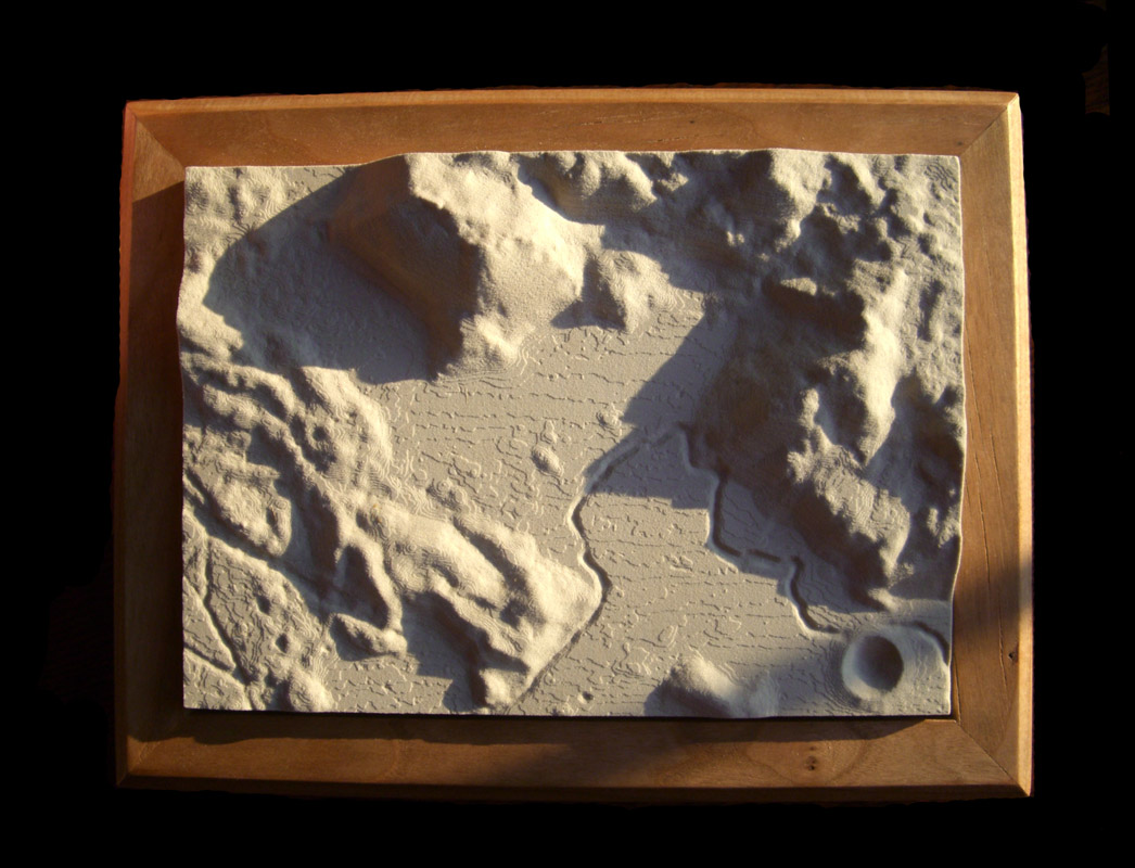
north to the left image of Apollo 15 area constructed by Howard Fink, New York
The problem with the Moon is that the illumination always comes from a limited range of azimuths, so the shadows best emphasize features that are perpendicular to those directions. But with a three dimensional model of a lunar scene you can rotate it to have illumination from any direction. Here, the Sun is to the south, casting a shadow from the Hadley Delta peak over the big bend in the Hadley Rille. Such rotations can be performed within a computer using digital terrain models (DTM), and Howard has demonstrated how those same lines of zeros and ones can be transformed into a physical depiction of the lunar surface. He used a USGS digitized version of the old topographic map of the Apollo 15 area, which he read into Mathematica, converted into a 3D model with Maya, and printed with a rapid-prototyper or 3-D printer. Howard was very kind and gave me one of these 5" x 7" models which he mounted in a cherry frame. With the new Kaguya and LRO DTMs it will be possible for many people to make their own models of any part of the Moon, using a 3-D printer at a local university or service center. I am especially pleased to see this because in my review of technology and education I suggested that 3-D printers would soon be able to bring models of planetary landforms into our hands. I am so happy to have one!
Chuck Wood
Related Links
Rükl plate 22
Yesterday's LPOD: Alpine Moonrise
Tomorrow's LPOD: Peaks & Walls
COMMENTS?
Register, Log in, and join in the comments.


