Difference between revisions of "July 12, 2010"
| Line 12: | Line 12: | ||
<strong>Related Links</strong><br /> | <strong>Related Links</strong><br /> | ||
Rükl plate [https://the-moon.us/wiki/R%C3%BCkl_62 62]<br /> | Rükl plate [https://the-moon.us/wiki/R%C3%BCkl_62 62]<br /> | ||
| − | [http://lpod. | + | [http://www2.lpod.org/wiki/August_27,_2009 Tracks in Tsiolkovskiy]<br /> |
<br /> | <br /> | ||
<p><b>Yesterday's LPOD:</b> [[July 11, 2010|Misreading the Moon]] </p> | <p><b>Yesterday's LPOD:</b> [[July 11, 2010|Misreading the Moon]] </p> | ||
Latest revision as of 07:28, 28 October 2018
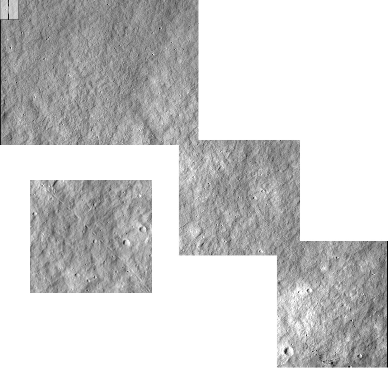
A Long Trail

image by LRO-NAC image M116582739R
Maurice Collins sent me an image of a long boulder trail cut from an LRO Narrow Angle Camera image of part of the rim of Schiller at 52.1°S and 41.5°W. I went to the long swath to explore it and discovered this longer trail - I think - that has larger bounce pits. The three overlapping images show that the trail already exists at the right bottom of the image and that it keeps going at the top left edge under the small index map. I counted 117 bounce pits, and trail visible here stretches 2.0 km (I think - not completely certain of the scale). The main image is at 50% of full resolution and the square at left center is a full resolution snippet from the middle scene of the mosaic. The boulder bounded from right to left. It is not possible to tell that for this track itself (because the ends are missing) but many other trails exist on the full image and the downslope movement is to the left. Many of the trails start at concentrations of bright rocks where a rocky part of the rim outcrops.
Chuck Wood
Related Links
Rükl plate 62
Tracks in Tsiolkovskiy
Yesterday's LPOD: Misreading the Moon
Tomorrow's LPOD: Unlocatable Discovery
COMMENTS?
Register, Log in, and join in the comments.


