Difference between revisions of "November 2, 2014"
| Line 15: | Line 15: | ||
<em>[http://lpod.wikispaces.com/21st+Century+Atlas+of+the+Moon 21st Century Atlas]</em> chart 15.<br /> | <em>[http://lpod.wikispaces.com/21st+Century+Atlas+of+the+Moon 21st Century Atlas]</em> chart 15.<br /> | ||
<br /> | <br /> | ||
| + | <p><b>Yesterday's LPOD:</b> [[November 1, 2014|Don't Believe Everything On the Big Screen]] </p> | ||
| + | <p><b>Tomorrow's LPOD:</b> [[November 3, 2014|True?]] </p> | ||
<hr /> | <hr /> | ||
Revision as of 12:29, 7 February 2015
Upside Down

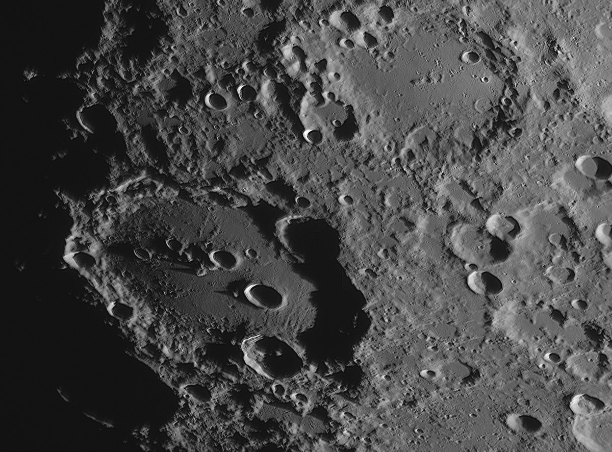
image by Clyde Foster, South Africa
I learned my way around the Moon with a home-made 5" Newtonian telescope that showed features with south up. And all lunar maps and photos were published with that orientation until 1960 when the IAU flipped N and S. So my first reaction to Cyde's north up image of Clavius was that it seemed new and unusual. And that momentary unfamiliarity made me look at it with a fresh mind, rather than just confirming that what I knew was visible. This sunrise image emphasizes the large collection of smooth-floored ponds to the north and east. Normally, such ponds around a crater would be considered to be filled with impact melt, but Clavius is so old that its impact melt deposits were long ago pulverized into featureless plains. The ponds and many others in the southern highlands are probably ejecta, not from individual craters but from basin-forming impacts, specifically Orientale. At least that is what most lunar scientists accept even though crater counts on various plains suggest they are of different ages.
Chuck Wood
Technical Details
1 November, 2014, 17.19UT. 355mm SCT at f11 with ZWO ASI120MM camera and Astronomik 2c Red filter.
Related Links
21st Century Atlas chart 15.
Yesterday's LPOD: Don't Believe Everything On the Big Screen
Tomorrow's LPOD: True?


