image provided by Xavier Debeerst
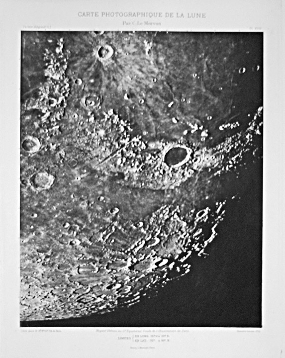
The earliest photos of the Moon were of very low quality but by the 1880s the 36″ Lick Observatory and the 23.6″ Paris Observatory refractors were being used to acquire photos that depicted the surface at resolutions that led to the end of hand drawn map-making. The Paris photos were widely distributed in a number of atlas formats, including a 1914 edition called Carte Photographique de la Lune by Puiseux and Loewy (edited by Charles Le Morvan). This image of a broad area centered on Plato and the Alpine Valley is probably not as sharp as the original image (based on the slightly out of focus title) but is quite respectable. I remember seeing some large Paris Atlas prints (printed not photographic) in the early 1960s that were very grainy when seen up close but acceptable from a distance. These images should have transformed the study of the Moon, but surprisingly few geologic studies seemed to have been based on them. Instead, observers persisted in chasing after tiny and often illusionary crater pits whose existed mattered not at all. Interestingly, photos of this quality would not be accepted for LPOD, today’s amateurs achieve much higher resolution!
Technical Details:
17/04/1902, 8h 8m 10s. 74 cm f/60 refractor. Image size 31.4 X 25.6 cm.
I thank Xavier for the image!
Related Links:
The Paris Atlas
More Paris Atlas prints
COMMENTS?
Register, and click on the Discussion tab at the top of the page.


