Difference between revisions of "July 27, 2014"
| (One intermediate revision by the same user not shown) | |||
| Line 15: | Line 15: | ||
<br /> | <br /> | ||
<strong>Related Links</strong><br /> | <strong>Related Links</strong><br /> | ||
| − | Rükl plate [ | + | Rükl plate [https://the-moon.us/wiki/Rükl_46 46]<br /> |
21st Century Atlas of the Moon: plates 7 and 12<br /> | 21st Century Atlas of the Moon: plates 7 and 12<br /> | ||
<br /> | <br /> | ||
Latest revision as of 19:46, 18 August 2018
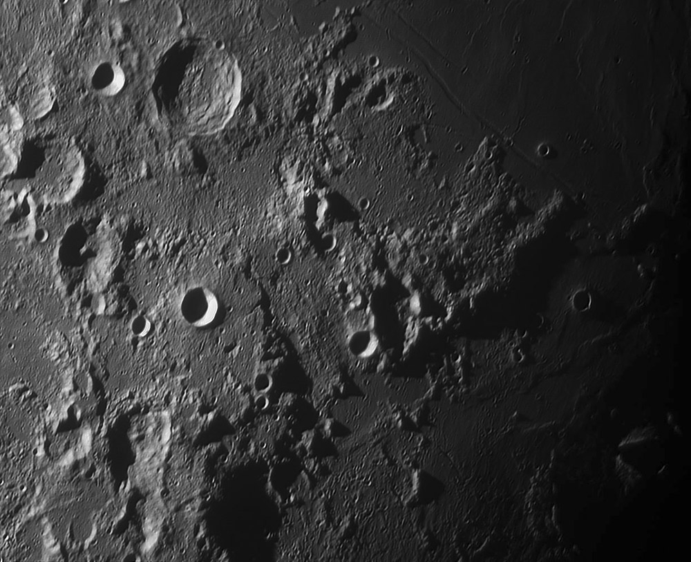
A Tortured Terrain

image by Pavel Presnyakov, Kiev Ukraine
The upper right side of Pavel's image includes Mare Tranquillitatis, and the area below is the end of the Altai Scarp rim of the Nectaris Basin. Everything else here is harder to explain. To the east of Delambre is a large, old half crater, the missing portion probably downfaulted by the Tranquillitatis Basin and now covered by the maria. Alfraganus, the bright rimmed simple crater at left center is on a plateau that looks like a remnant of an older surface that has been destroyed everywhere else. What is the origin of the broad trough east of Alfraganus that contains striated material that appears to have flowed southward? And between Alfraganus and Delambre is an ill-defined curved depression of unknown origin. This area has attracted LPOD's attention before and will again for it had a tumultuous past that is just beyond the realm of comprehension.
Chuck Wood
This is a classic LPOD from Aug 28, 2009 - about 5 years ago.
Technical Details
August 11, 2009 00:01 UT. 350 mm newtonian + barlow 3x + extender Vac-135, b/w 1280x1024; 250 frames from 3000 in AviStack and Registax
Related Links
Rükl plate 46
21st Century Atlas of the Moon: plates 7 and 12
Yesterday's LPOD: Airbrushed Out?
Tomorrow's LPOD: Quantified Mountain
COMMENTS?
Register, Log in, and join in the comments.


