Difference between revisions of "February 28, 2011"
| Line 21: | Line 21: | ||
<br /> | <br /> | ||
<strong>Related Links</strong><br /> | <strong>Related Links</strong><br /> | ||
| − | Rükl plate [https://the-moon.us/wiki/R%C3% | + | Rükl plate [https://the-moon.us/wiki/R%C3%BCkl_51 51]<br /> |
USGS Atlas of the Moon [http://planetarynames.wr.usgs.gov/images/Lunar/lac_93_lo.pdf LAC 93]<br /> | USGS Atlas of the Moon [http://planetarynames.wr.usgs.gov/images/Lunar/lac_93_lo.pdf LAC 93]<br /> | ||
Harald's [http://www.unigraph.de/ website]<br /> | Harald's [http://www.unigraph.de/ website]<br /> | ||
Latest revision as of 17:46, 13 October 2018
No Satellite Needed

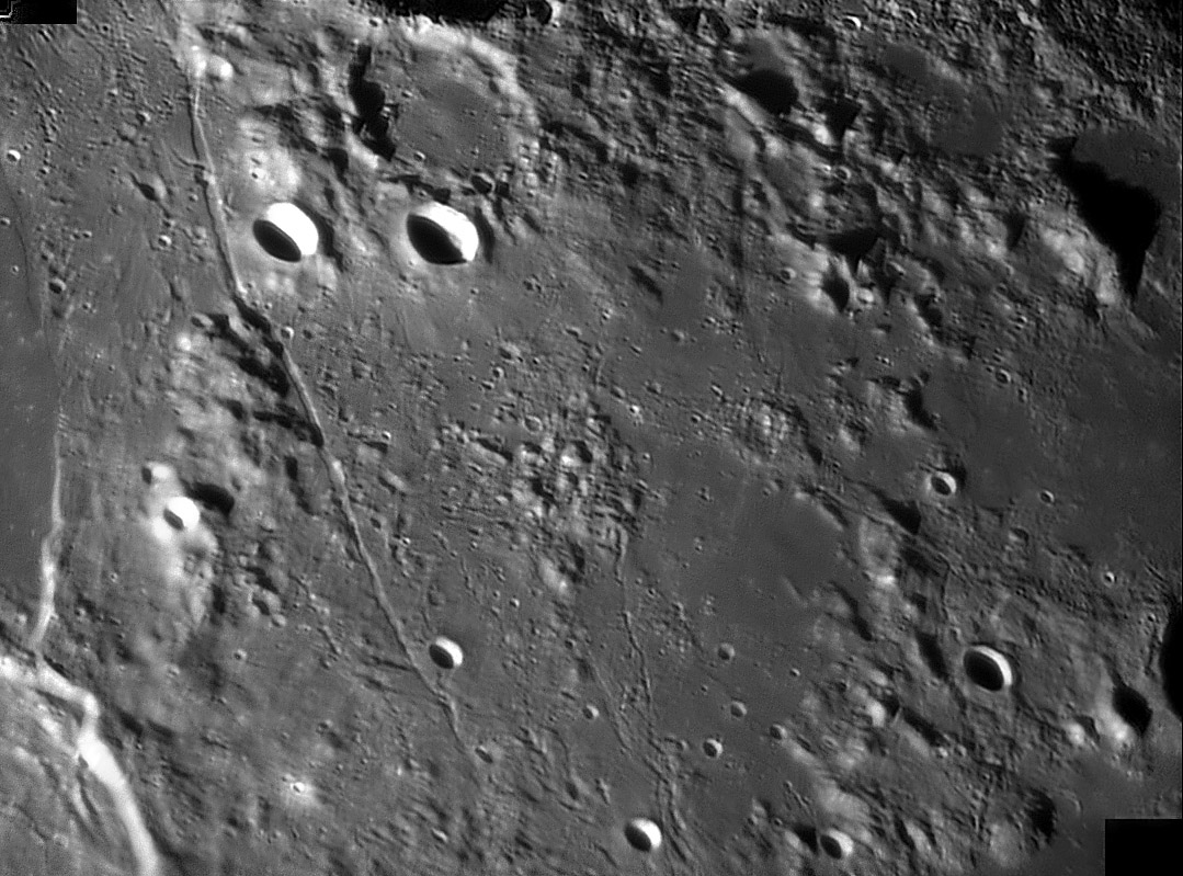
image by Harald Paleske, Langendorf, Germany
This isn't another LRO Wide Angle Camera mosaic, but with its smooth tones and excellent resolution
it does look like it. This is an area you may not recognize immediately. There are a couple of linear rilles
of different morphologies cutting through a rubbly area, and two bright craters, like headlights, announce
the area when their names are given: Mersenius S and C. Mersenius is off the image at the top, and just
a corner of Gassendi's rim is on the left. The rubble is ejecta from the Humorum Basin and Gassendi. The
three ridges are parts of rims of the the basin, the Percy Mountains at left and an unnamed mountain chain
at right with a clumpy bit of an intermediate ring in between. I don't know what forces caused these north
-south rilles to form. They don't seem related to the Humorum Basin or anything else.
Chuck Wood
Technical Details
16.01.201. 16 inch Newton, DMK31, red filter, stack 125frames, sharpening with deconvolution
Related Links
Rükl plate 51
USGS Atlas of the Moon LAC 93
Harald's website
Yesterday's LPOD: Nectaris Rilles
Tomorrow's LPOD: Ray-Streaked Mare
COMMENTS?
Register, Log in, and join in the comments.


