Difference between revisions of "July 26, 2018"
| Line 18: | Line 18: | ||
<br /> | <br /> | ||
<strong>Related Links</strong><br /> | <strong>Related Links</strong><br /> | ||
| − | Rükl plate [https://the-moon.us/wiki/ | + | Rükl plate [https://the-moon.us/wiki/Rükl_4 4]<br /> |
</td> | </td> | ||
</tr> | </tr> | ||
Revision as of 19:46, 18 August 2018
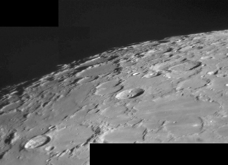
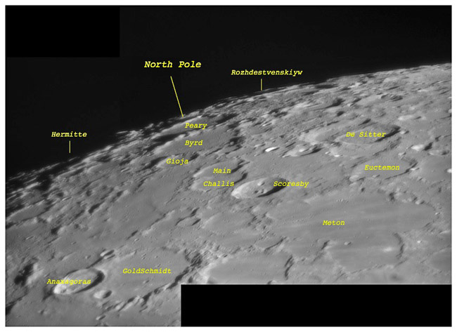
Beyond North
Originally published May 11, 2009

image by Jocelyn Sérot, France
 |
With a strong libration in latitude of +6°11 when Jocelyn took this image, the North Pole region is strongly tipped into view. Yet we can only see a little more than was visible in the LPOD of two months ago. But no matter how good the libration, this polar region is simply much less spectacular than the area around the South Pole. What basins are responsible for the morphology extremes of both poles. The high mountains of the South Pole are actually parts of the rim of the giant South Pole-Aitken Basin. The North Pole terrain is also dominated by a basin, but this time it is the ejecta from the Imbrium Basin that filled in crater floors and smoothed over other low spots, reducing topographic relief. There must be similar thick deposits of ejecta around SP-A, but that basin is so old that all the visible craters we see in the South Pole region are younger than its ejecta. The opposite is true for the approach to the North Pole - most craters there are older than the Imbrium Basin and its ejecta. For the Moon, the word "basin" is often the answer, now what is the question?
|
Yesterday's LPOD: Little Known Polar Valleys
Tomorrow's LPOD: Almost Nothing
COMMENTS?
Register, Log in, and join in the comments.


