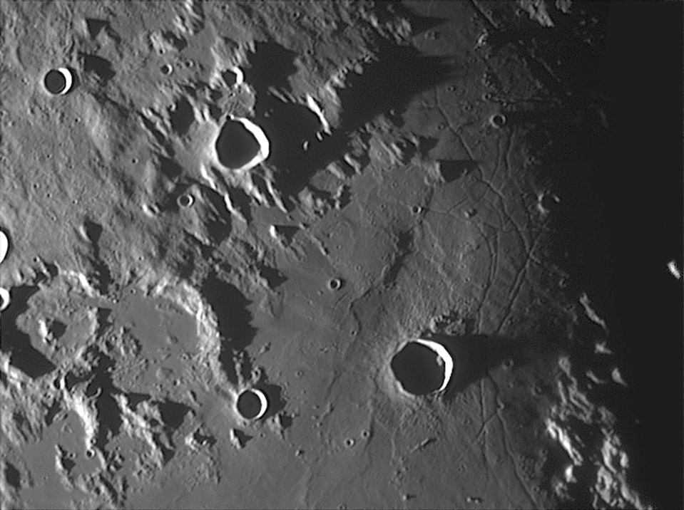
image by [mailto: Stefan Lammel], Uxbridge, England
Continuing east from yesterday’s LPOD takes us to one of the classic, but poorly understood, features on the Moon. Triesnecker is a 26 km wide complex crater whose ejecta is draped over the adjacent smooth terrain, but the feature of interest is a labyrinth of narrow linear rilles to the east. I don’t know why the rilles are here. Some rilles in other parts of the Moon are surface expressions of volcanic dikes (or dykes as spelled in UK); if these are also, the question is why was there such a concentration of dikes in this region? The low lighting and high resolution of Stefan’s shot emphasizes the undulating ground that the rilles cut. West of Triesnecker is a shallow depression that seems to be a broad valley covered by whatever the smooth material is (wait for tomorrow).
Technical Details:
14 October, 2006, 03.04 UT. 10″ f4.8 Newtonian + DMK21-AF0 + 4x Powermate. Registax v4: 600 frames from 5000; MAP: 12 x 128.
Related Links:
Rükl chart 33
Stefan’s website
Yesterday's LPOD: Move Over Orbiter
Tomorrow's LPOD: Digging Below the Surface


