March 4, 2018
The Other Side
Originally published October 6, 2008

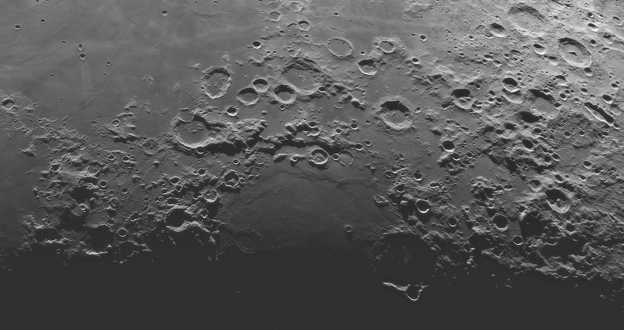
image by Павел Пресняков (Pavel Presnyakov), Kiev, Ukraine
Every basin is a circular depression surrounded by elevated rings. And almost every basin has great differences in the continuity of its rings. Some, such as the western rim of Imbrium, totally disappear, and others almost do. The reasons for the disappearance of basin rings is not certain - some may be missing where pre-existing terrain was low, or maybe an oblique impact created low rings in the up-range direction. The Nectaris Basin has a prominent 90° long basin ring segment - the Altai Scarp - but the remainder of it's rings are much less conspicuous. Here, rotated on its side so that north is to the left, is the much less frequently imaged half of the Nectaris Basin. There is a broken sense of circular symmetry but your imagination must link together sometimes isolated hills to define a ring. An inner ring bounding the small puddle of mare is best marked by the Pyrenees Mountains, and the outer ring - the continuation of the Altai - is visible where higher, plateau-like remnants are adjacent to lower, flatter land; this is especially noticeable on the far left. The only concentric rilles that the Nectaris Basin has is to the left, but it is not clear if they are concentric to Nectaris or radial to Imbrium.
Chuck Wood
Technical Details
21.05.2007. Таl-250К, VAC-135.
Pavel's website
Pavel's entire mosaic, from which today's LPOD was cut.
Yesterday's LPOD: Farside Lightness
Tomorrow's LPOD: The Beginning
COMMENTS?
Register, Log in, and join in the comments.


