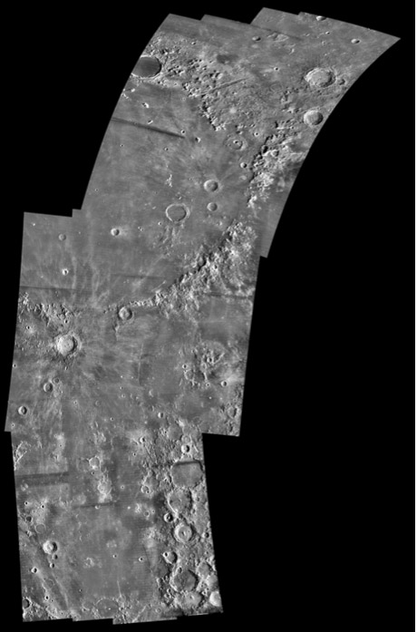
mosaic from US Geological Survey
How much longer will we not have a quality photomap of the Moon? Despite the Moon’s nearness to Earth, and the dozens of space missions that we have sent there, the Moon has no adequate global image map. This is a section of the newest photomap (still under construction) that uses some of the oldest lunar orbital images. The Astrogeology Branch of the US Geological Survey in Flagstaff, Arizona is creating a mosaic of the lunar nearside using the high resolution (few hundred meters, not the coarse res shown here) Lunar Orbiter IV photos of 1965. This nearside mosaic will have nearly constant resolution and sun angles, but there is only lower resolution images for the eastern area of the Moon where Orbiter IV malfunctioned. A second photomoasic of the entire Moon was created from Clementine images. That image map is widely available but has the significant disadvantage of having an illumination angle that varies from zero at the poles to full Moon at the equator. The only other hemisphere-wide photographic lunar mosaic was created by Pablo Lonnie Pacheco Railey who used Photoshop to combine hundreds of photos from the Earth-based Consolidated Lunar Atlas. Finally, the European Space Agency probe, SMART-1, appears to be imaging the entire nearside (and farside??), but I do not know if the look angles will be consistent so that a new global mosaic can be contructed from them. Hopefully, the SMART-1 images will be cataloged and released soon. And when the US, Chinese and Indian probes reach the Moon in 2008 or so will they finally collect data to generate a global, high resolution, constant sun angle, digital imagemap of the Moon? I hope so.
Technical Details:
see link under image.
Note added later: Don’t think that the image shown is an example of the woeful state of lunar image maps! It will be the best one in existence when released, but it will not be as good as what we ideally need. We need a new global database of images - they will be here in a few years.
Related Links:
Rükl chart: lots
Yesterday's LPOD: Ring the Bell
Tomorrow's LPOD: Where Have All the Craters Gone?
COMMENTS?
Register, Log in, and join in the comments.


