Difference between revisions of "October 27, 2013"
| Line 21: | Line 21: | ||
<br /> | <br /> | ||
<strong>Related Links</strong><br /> | <strong>Related Links</strong><br /> | ||
| − | <em>[ | + | <em>[[21st Century Atlas of the Moon|21st Century Atlas]]</em> chart 7.<br /> |
<br /> | <br /> | ||
<p><b>Yesterday's LPOD:</b> [[October 26, 2013|Where Were the Landings?]] </p> | <p><b>Yesterday's LPOD:</b> [[October 26, 2013|Where Were the Landings?]] </p> | ||
Latest revision as of 08:36, 28 October 2018
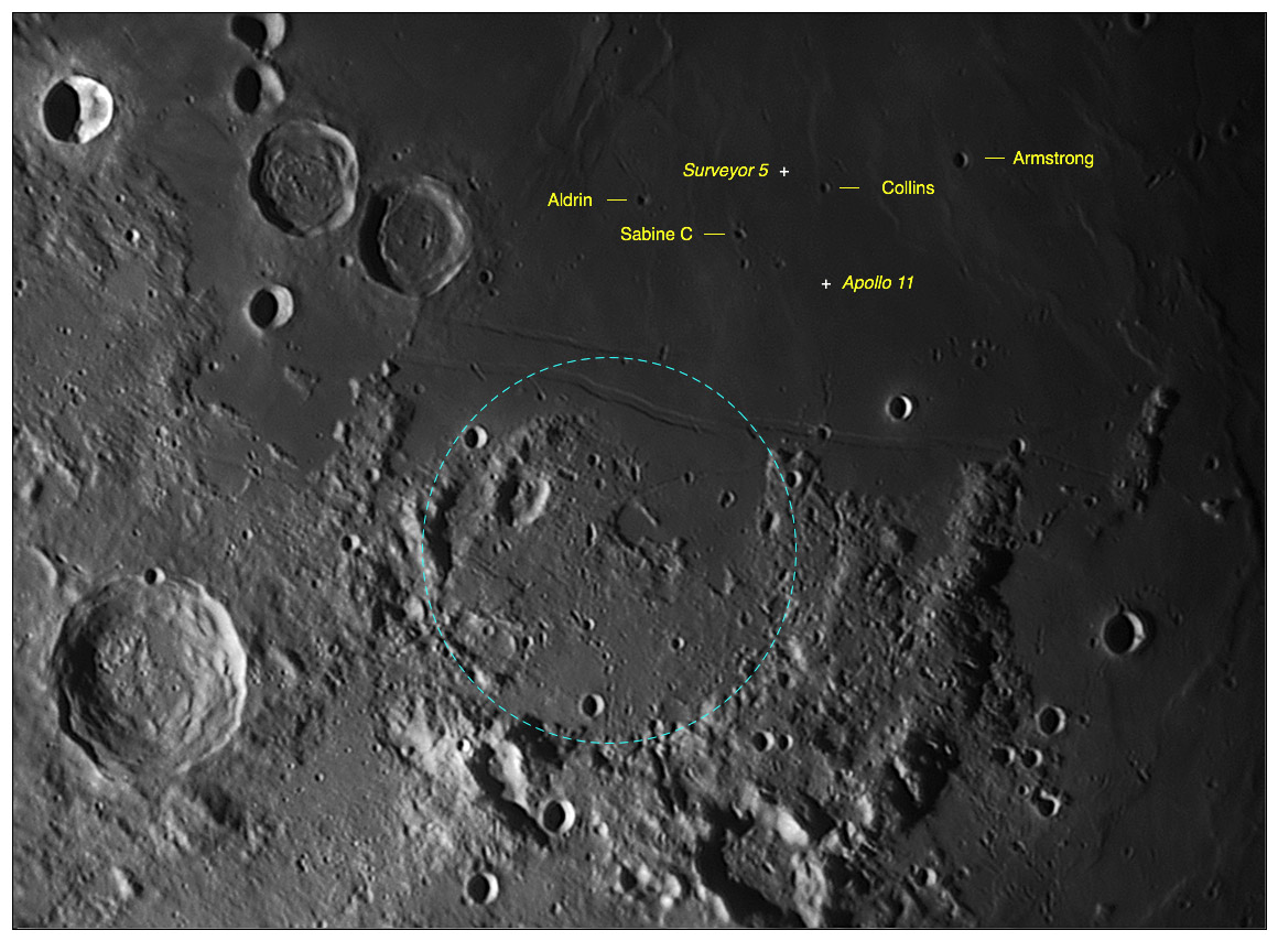
Ancient Fracastorius

image by Jocelyn Serot, France
In echo to yesterday's LPOD, here's a view including the Apollo 11 (and also Surveyor 5) landing site(s). While annotating it, and looking at
the Hypatia rilles, it just occured to me that the "coastal" region north of Hypatia shows a broad semi-circular shape (in blue). Could it be
that an old crater is hiding there, with the north section of its rim buried under the lavas of M. Tranquillitatis and its south part veneered by
the ejecta from the corresponding basin (some kind of Fracastorius, at a larger scale)?
Jocelyn Serot
CAW Note: Yes, that probably is a Fracastorius type crater, tipped toward the basin which later filled with lava. In the System of Lunar Craters
we interpreted this feature as extending (bottom right corner of map) a little further to the east.
Technical Details
2013-10-24, 3h48 UT. C11 @ f/d=19 (E=0.14"/pixel). R filter. Basler 1300 cam. Processing: AS!2 +RS6 + PS2.
Related Links
21st Century Atlas chart 7.
Yesterday's LPOD: Where Were the Landings?
Tomorrow's LPOD: The Real Fracastorius
COMMENTS?
Register, Log in, and join in the comments.


